 |
|
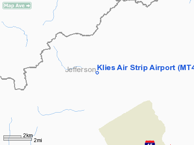
Location & QuickFacts
| FAA Information Effective: | 2008-09-25 |
| Airport Identifier: | MT43 |
| Airport Status: | Operational |
| Longitude/Latitude: | 112-20-37.0550W/46-20-46.7470N
-112.343626/46.346319 (Estimated) |
| Elevation: | 6300 ft / 1920.24 m (Estimated) |
| Land: | 22 acres |
| From nearest city: | 6 nautical miles NW of Basin, MT |
| Location: | Jefferson County, MT |
| Magnetic Variation: | 16E (1985) |
Owner & Manager
| Ownership: | Privately owned |
| Owner: | Forrest L Klies |
| Address: | Po Box 153
Basin Montana 59631 |
| Phone number: | 406-439-0653 |
| Manager: | Forrest L Klies |
| Address: | Po Box 153
Basin Montana 59631 |
| Phone number: | 406-439-0653 |
Airport Operations and Facilities
| Airport Use: | Private
PERSONAL USE. |
| Wind indicator: | Yes |
| Segmented Circle: | No |
| Control Tower: | No |
| Sectional chart: | Great Falls |
| Region: | ANM - Northwest Mountain |
| Boundary ARTCC: | ZLC - Salt Lake City |
| Tie-in FSS: | GTF - Great Falls |
| FSS Toll Free: | 1-800-WX-BRIEF |
Airport Services
Runway Information
Runway 11/29
| Dimension: | 1770 x 30 ft / 539.5 x 9.1 m |
| Surface: | TURF-GRVL, |
| |
Runway 11 |
Runway 29 |
| Traffic Pattern: | Left | Left |
| Obstruction: | | 100 ft trees, 500.0 ft from runway |
|
Radio Navigation Aids
| ID |
Type |
Name |
Ch |
Freq |
Var |
Dist |
| CVP | NDB | Capitol | | 335.00 | 16E | 23.0 nm |
| HAU | NDB | Hauser | | 386.00 | 16E | 27.7 nm |
| DRU | VOR | Drummond | | 117.10 | 17E | 39.0 nm |
| CPN | VOR/DME | Coppertown | 053X | 111.60 | 16E | 25.3 nm |
| HLN | VORTAC | Helena | 124X | 117.70 | 16E | 22.5 nm |
| HIA | VORTAC | Whitehall | 084X | 113.70 | 18E | 30.0 nm |
Remarks
- MOOSE & ELK FREQUENT THE STRIP.
- 500' OVRNAT S END OF STRIP RUNNING INTO 100' TREES.
Images and information placed above are from
http://www.airport-data.com/airport/MT43/
We thank them for the data!
| General Info
|
| Country |
United States
|
| State |
MONTANA
|
| FAA ID |
MT43
|
| Latitude |
46-20-46.747N
|
| Longitude |
112-20-37.055W
|
| Elevation |
6300 feet
|
| Near City |
BASIN
|
We don't guarantee the information is fresh and accurate. The data may
be wrong or outdated.
For more up-to-date information please refer to other sources.
|
|


