 |
|
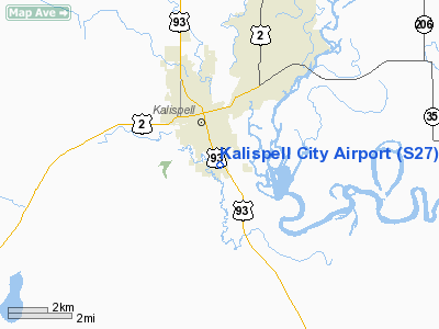
Location & QuickFacts
| FAA Information Effective: | 2008-09-25 |
| Airport Identifier: | S27 |
| Airport Status: | Operational |
| Longitude/Latitude: | 114-18-13.4670W/48-10-42.8500N
-114.303741/48.178569 (Estimated) |
| Elevation: | 2932 ft / 893.67 m (Surveyed) |
| Land: | 134 acres |
| From nearest city: | 1 nautical miles S of Kalispell, MT |
| Location: | Flathead County, MT |
| Magnetic Variation: | 19E (1985) |
Owner & Manager
| Ownership: | Publicly owned |
| Owner: | City Of Kalispell |
| Address: | City Hall
Kalispell, MT 59901 |
| Phone number: | 406-758-7774 |
| Manager: | Fred Leistiko |
| Address: | Box 1997
Kalispell, MT 59903 |
| Phone number: | 406-250-3065 |
Airport Operations and Facilities
| Airport Use: | Open to public |
| Wind indicator: | Yes |
| Segmented Circle: | No |
| Control Tower: | No |
| Lighting Schedule: | DUSK-DAWN
ACTVT LIRL RY 13/31 - CTAF. |
| Beacon Color: | Clear-Green (lighted land airport) |
| Landing fee charge: | No |
| Sectional chart: | Great Falls |
| Region: | ANM - Northwest Mountain |
| Boundary ARTCC: | ZLC - Salt Lake City |
| Tie-in FSS: | GTF - Great Falls
COMMUNICATIONS PRVDD BY GREAT FALLS RADIO ON FREQ 122.5 (LAKESIDE RCO). |
| FSS on Airport: | No |
| FSS Toll Free: | 1-800-WX-BRIEF |
| NOTAMs Facility: | GTF (NOTAM-d service avaliable) |
| Federal Agreements: | N |
Airport Communications
| CTAF: | 122.800 |
| Unicom: | 122.800 |
Airport Services
| Fuel available: | 100LLA |
| Airframe Repair: | MAJOR |
| Power Plant Repair: | MAJOR |
Runway Information
Runway 13/31
| Dimension: | 3600 x 60 ft / 1097.3 x 18.3 m |
| Surface: | ASPH, Good Condition |
| Weight Limit: | Single wheel: 4000 lbs. |
| Edge Lights: | Non-standard lighting system
NSTD LIRL. RY 13 THR LGTS LOCATED AT END OF RY. |
| |
Runway 13 |
Runway 31 |
| Alignment: | 127 | 0 |
| Traffic Pattern: | Left | Left |
| Markings: | Basic, Good Condition | Basic, Good Condition |
| Displaced threshold: | 0.00 ft | 155.00 ft
LGTD THR RELOCATED 155 FT FOR NIGHT OPNS; 3445 FT OF RY 13/31 LGTD AT NIGHT. |
| Obstruction: | 45 ft tree, 693.0 ft from runway, 161 ft left of centerline, 10:1 slope to clear | 324 ft towers, 5750.0 ft from runway, 505 ft right of centerline, 17:1 slope to clear |
|
Radio Navigation Aids
| ID |
Type |
Name |
Ch |
Freq |
Var |
Dist |
| SAK | NDB | Smith Lake | | 515.00 | 18E | 7.6 nm |
| PLS | NDB | Polson | | 275.00 | 20E | 29.4 nm |
| LYI | NDB | Libby | | 414.00 | 17E | 48.3 nm |
| FCA | VOR/DME | Kalispell | 079X | 113.20 | 18E | 5.5 nm |
Remarks
- POOR APCHS IF UNFAMILIAR USE CTN.
- GLIDER & BALLOON ACTIVITY ON & INVOF ARPT.
- TWR 400 FT AGL 3 MILES E UNLGTD.
- EXISTED PRIOR TO 1959.
Images and information placed above are from
http://www.airport-data.com/airport/S27/
We thank them for the data!
| General Info
|
| Country |
United States
|
| State |
MONTANA
|
| FAA ID |
S27
|
| Latitude |
48-10-42.850N
|
| Longitude |
114-18-13.467W
|
| Elevation |
2932 feet
|
| Near City |
KALISPELL
|
We don't guarantee the information is fresh and accurate. The data may
be wrong or outdated.
For more up-to-date information please refer to other sources.
|
|


