 |
|
Location & QuickFacts
| FAA Information Effective: | 2008-09-25 |
| Airport Identifier: | JDN |
| Airport Status: | Operational |
| Longitude/Latitude: | 106-57-09.6800W/47-19-43.5000N
-106.952689/47.328750 (Estimated) |
| Elevation: | 2662 ft / 811.38 m (Surveyed) |
| Land: | 234 acres |
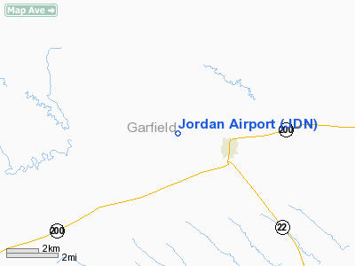
| From nearest city: | 2 nautical miles NW of Jordan, MT |
| Location: | Garfield County, MT |
| Magnetic Variation: | 14E (1985) |
Owner & Manager
| Ownership: | Publicly owned |
| Owner: | Garfield County |
| Address: | Po Box 7
Jordan, MT 59337 |
| Phone number: | 406-557-2760 |
| Manager: | Rod Weeding |
| Address: | Po Box 150
Jordan, MT 59337 |
| Phone number: | 406-557-2552 |
Airport Operations and Facilities
| Airport Use: | Open to public |
| Wind indicator: | Yes |
| Segmented Circle: | Yes |
| Control Tower: | No |
| Lighting Schedule: | DUSK-DAWN
ACTVT MIRL RY 10/28 & PAPI RY 28 - CTAF. |
| Beacon Color: | Clear-Green (lighted land airport) |
| Landing fee charge: | No |
| Sectional chart: | Billings |
| Region: | ANM - Northwest Mountain |
| Boundary ARTCC: | ZLC - Salt Lake City |
| Tie-in FSS: | GTF - Great Falls |
| FSS on Airport: | No |
| FSS Toll Free: | 1-800-WX-BRIEF |
| NOTAMs Facility: | JDN (NOTAM-d service avaliable) |
| Federal Agreements: | NGY |
Airport Communications
Airport Services
| Airframe Repair: | NONE |
| Power Plant Repair: | NONE |
| Bottled Oxygen: | NONE |
| Bulk Oxygen: | NONE |
Runway Information
Runway 10/28
| Dimension: | 4300 x 75 ft / 1310.6 x 22.9 m |
| Surface: | ASPH, Good Condition |
| Surface Treatment: | Porous Friction Course |
| Weight Limit: | Single wheel: 12500 lbs. |
| Edge Lights: | Medium |
| |
Runway 10 |
Runway 28 |
| Traffic Pattern: | Left | Left |
| Markings: | Basic, Good Condition | Basic, Good Condition |
| Crossing Height: | 0.00 ft | 29.00 ft |
| VASI: | | 2-light PAPI on left side |
| Visual Glide Angle: | 0.00° | 3.00° |
| Obstruction: | 12 ft fence, 350.0 ft from runway, 13:1 slope to clear
+10 FT RISING TRRN 100 FT L PARALLEL TO RY CNTRLN. | 14 ft road, 640.0 ft from runway, 31:1 slope to clear |
|
Radio Navigation Aids
| ID |
Type |
Name |
Ch |
Freq |
Var |
Dist |
| JDN | NDB | Jordan | | 263.00 | 16E | 0.7 nm |
Remarks
Images and information placed above are from
http://www.airport-data.com/airport/JDN/
We thank them for the data!
| General Info
|
| Country |
United States
|
| State |
MONTANA
|
| FAA ID |
JDN
|
| Latitude |
47-19-42.000N
|
| Longitude |
106-57-07.000W
|
| Elevation |
2662 feet
|
| Near City |
JORDAN
|
We don't guarantee the information is fresh and accurate. The data may
be wrong or outdated.
For more up-to-date information please refer to other sources.
|
|


