 |
|
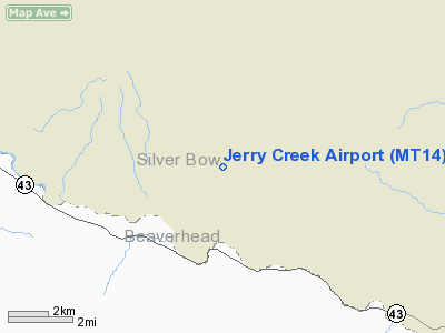
Location & QuickFacts
| FAA Information Effective: | 2008-09-25 |
| Airport Identifier: | MT14 |
| Airport Status: | Operational |
| Longitude/Latitude: | 112-53-10.1270W/45-49-24.7320N
-112.886146/45.823537 (Estimated) |
| Elevation: | 5940 ft / 1810.51 m (Estimated) |
| Land: | 50 acres |
| From nearest city: | 4 nautical miles NE of Wise River, MT |
| Location: | Silver Bow County, MT |
| Magnetic Variation: | 17E (1985) |
Owner & Manager
| Ownership: | Privately owned |
| Owner: | Frank R. Primozic |
| Address: | Gen Del
Wise River, MT 59762 |
| Phone number: | 406-832-3299 |
| Manager: | Frank R. Primozic |
| Address: | Gen Del
Wise River, MT 59762 |
| Phone number: | 406-832-3299 |
Airport Operations and Facilities
| Airport Use: | Private |
| Segmented Circle: | No |
| Control Tower: | No |
| Sectional chart: | Great Falls |
| Region: | ANM - Northwest Mountain |
| Boundary ARTCC: | ZLC - Salt Lake City |
| Tie-in FSS: | GTF - Great Falls |
| FSS on Airport: | No |
| FSS Toll Free: | 1-800-WX-BRIEF |
Runway Information
Runway 03/21
| Dimension: | 1700 x 30 ft / 518.2 x 9.1 m |
| Surface: | TURF, Poor Condition |
| |
Runway 03 |
Runway 21 |
| Traffic Pattern: | Left | Left |
|
Radio Navigation Aids
| ID |
Type |
Name |
Ch |
Freq |
Var |
Dist |
| CPN | VOR/DME | Coppertown | 053X | 111.60 | 16E | 13.8 nm |
| DLN | VOR/DME | Dillon | 077X | 113.00 | 18E | 37.4 nm |
| HIA | VORTAC | Whitehall | 084X | 113.70 | 18E | 30.1 nm |
Remarks
- OWNER DESIRES ARPT NOT BE CHARTED.
Images and information placed above are from
http://www.airport-data.com/airport/MT14/
We thank them for the data!
| General Info
|
| Country |
United States
|
| State |
MONTANA
|
| FAA ID |
MT14
|
| Latitude |
45-49-24.732N
|
| Longitude |
112-53-10.127W
|
| Elevation |
5940 feet
|
| Near City |
WISE RIVER
|
We don't guarantee the information is fresh and accurate. The data may
be wrong or outdated.
For more up-to-date information please refer to other sources.
|
|


