 |
|
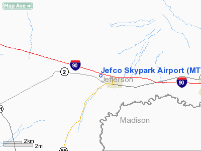
Location & QuickFacts
| FAA Information Effective: | 2008-09-25 |
| Airport Identifier: | MT41 |
| Airport Status: | Operational |
| Longitude/Latitude: | 112-07-01.9830W/45-52-41.7350N
-112.117217/45.878260 (Estimated) |
| Elevation: | 4510 ft / 1374.65 m (Estimated) |
| Land: | 145 acres |
| From nearest city: | 1 nautical miles W of Whitehall, MT |
| Location: | Jefferson County, MT |
| Magnetic Variation: | 17E (1985) |
Owner & Manager
| Ownership: | Privately owned |
| Owner: | Jefco Skypark Homeowners Asso |
| Address: | Box 148
Whitehall, MT 59759 |
| Phone number: | 406-287-3441 |
| Manager: | Justin Fuhrer, Vice President |
| Address: | Po Box 227
Whitehall, MT 59759 |
| Phone number: | 406-287-3441 |
Airport Operations and Facilities
| Airport Use: | Private |
| Wind indicator: | Yes |
| Segmented Circle: | No |
| Control Tower: | No |
| Lighting Schedule: | RDO-CTL
ACTVT LIRL RY 09/27 - CTAF. |
| Sectional chart: | Great Falls |
| Region: | ANM - Northwest Mountain |
| Boundary ARTCC: | ZLC - Salt Lake City |
| Tie-in FSS: | GTF - Great Falls |
| FSS Toll Free: | 1-800-WX-BRIEF |
Airport Communications
Runway Information
Runway 09/27
| Dimension: | 3800 x 60 ft / 1158.2 x 18.3 m |
| Surface: | TURF, |
| Edge Lights: | Low |
| |
Runway 09 |
Runway 27 |
| Traffic Pattern: | Left | Left |
| Obstruction: | 440 ft pline, 800.0 ft from runway | 440 ft pline, 1100.0 ft from runway |
|
Radio Navigation Aids
| ID |
Type |
Name |
Ch |
Freq |
Var |
Dist |
| EKS | NDB | Ennis | | 286.00 | 15E | 41.7 nm |
| HAU | NDB | Hauser | | 386.00 | 16E | 44.1 nm |
| CVP | NDB | Capitol | | 335.00 | 16E | 44.4 nm |
| CPN | VOR/DME | Coppertown | 053X | 111.60 | 16E | 27.9 nm |
| BZN | VOR/DME | Bozeman | 071X | 112.40 | 18E | 40.7 nm |
| DLN | VOR/DME | Dillon | 077X | 113.00 | 18E | 42.0 nm |
| HIA | VORTAC | Whitehall | 084X | 113.70 | 18E | 2.4 nm |
| HLN | VORTAC | Helena | 124X | 117.70 | 16E | 44.3 nm |
Remarks
Images and information placed above are from
http://www.airport-data.com/airport/MT41/
We thank them for the data!
| General Info
|
| Country |
United States
|
| State |
MONTANA
|
| FAA ID |
MT41
|
| Latitude |
45-52-41.735N
|
| Longitude |
112-07-01.983W
|
| Elevation |
4510 feet
|
| Near City |
WHITEHALL
|
We don't guarantee the information is fresh and accurate. The data may
be wrong or outdated.
For more up-to-date information please refer to other sources.
|
|


