 |
|
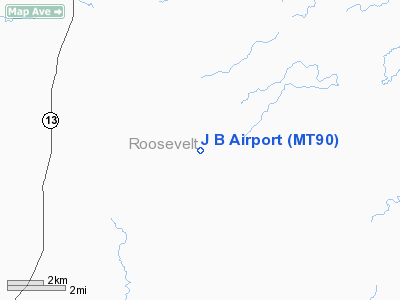
Location & QuickFacts
| FAA Information Effective: | 2008-09-25 |
| Airport Identifier: | MT90 |
| Airport Status: | Operational |
| Longitude/Latitude: | 105-20-05.9570W/48-23-16.0760N
-105.334988/48.387799 (Estimated) |
| Elevation: | 2710 ft / 826.01 m (Estimated) |
| Land: | 7 acres |
| From nearest city: | 22 nautical miles NE of Wolf Point, MT |
| Location: | Roosevelt County, MT |
| Magnetic Variation: | 14E (1985) |
Owner & Manager
| Ownership: | Privately owned |
| Owner: | Jeff Berg |
| Address: | 45 Callie Ct
Belgrade, MT 59714 |
| Phone number: | 406-600-7848 |
| Manager: | Jeff Berg |
| Address: | 45 Callie Ct
Belgrade, MT 59714 |
| Phone number: | 406-600-7848 |
Airport Operations and Facilities
| Airport Use: | Private |
| Wind indicator: | Yes |
| Segmented Circle: | No |
| Control Tower: | No |
| Landing fee charge: | No |
| Sectional chart: | Billings |
| Region: | ANM - Northwest Mountain |
| Boundary ARTCC: | ZLC - Salt Lake City |
| Tie-in FSS: | GTF - Great Falls |
| FSS on Airport: | No |
| FSS Toll Free: | 1-800-WX-BRIEF |
Runway Information
Runway 08/26
| Dimension: | 3900 x 75 ft / 1188.7 x 22.9 m |
| Surface: | DIRT, |
| |
Runway 08 |
Runway 26 |
| Traffic Pattern: | Left | Left |
| Obstruction: | | 25 ft pline, 300.0 ft from runway |
|
Radio Navigation Aids
| ID |
Type |
Name |
Ch |
Freq |
Var |
Dist |
| OLF | NDB | Wolf Point | | 404.00 | 11E | 20.1 nm |
| SCO | NDB | Scobey | | 283.00 | 16E | 25.6 nm |
| PWD | NDB | Plentywood | | 251.00 | 16E | 40.2 nm |
Images and information placed above are from
http://www.airport-data.com/airport/MT90/
We thank them for the data!
| General Info
|
| Country |
United States
|
| State |
MONTANA
|
| FAA ID |
MT90
|
| Latitude |
48-23-16.076N
|
| Longitude |
105-20-05.957W
|
| Elevation |
2710 feet
|
| Near City |
WOLF POINT
|
We don't guarantee the information is fresh and accurate. The data may
be wrong or outdated.
For more up-to-date information please refer to other sources.
|
|


