 |
|
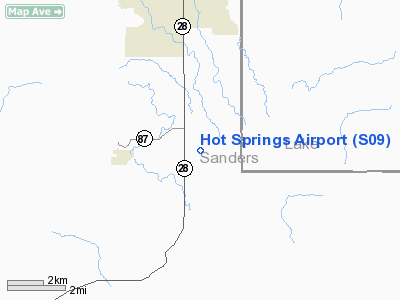
Location & QuickFacts
| FAA Information Effective: | 2008-09-25 |
| Airport Identifier: | S09 |
| Airport Status: | Operational |
| Longitude/Latitude: | 114-36-48.4660W/47-36-44.7740N
-114.613463/47.612437 (Estimated) |
| Elevation: | 2763 ft / 842.16 m (Surveyed) |
| Land: | 117 acres |
| From nearest city: | 2 nautical miles E of Hot Springs, MT |
| Location: | Sanders County, MT |
| Magnetic Variation: | 18E (1985) |
Owner & Manager
| Ownership: | Publicly owned |
| Owner: | Sanders County |
| Address: | Box 519
Thompson Falls, MT 59873 |
| Phone number: | 406-827-4316 |
| Manager: | Mark Loraas |
| Address: |
|
| Phone number: | 406-741-3582
OR 406-471-2423, OR DON THEALER AT 406-741-5040 |
Airport Operations and Facilities
| Airport Use: | Open to public |
| Wind indicator: | Yes |
| Segmented Circle: | No |
| Control Tower: | No |
| Lighting Schedule: | DUSK-DAWN |
| Beacon Color: | Clear-Green (lighted land airport) |
| Landing fee charge: | No |
| Sectional chart: | Great Falls |
| Region: | ANM - Northwest Mountain |
| Boundary ARTCC: | ZLC - Salt Lake City |
| Tie-in FSS: | GTF - Great Falls |
| FSS on Airport: | No |
| FSS Toll Free: | 1-800-WX-BRIEF |
| NOTAMs Facility: | GTF (NOTAM-d service avaliable) |
| Federal Agreements: | 1 |
Airport Communications
Airport Services
| Airframe Repair: | NONE |
| Power Plant Repair: | NONE |
| Bottled Oxygen: | NONE |
| Bulk Oxygen: | NONE |
Runway Information
Runway 06/24
| Dimension: | 3550 x 45 ft / 1082.0 x 13.7 m |
| Surface: | ASPH-TRTD, Fair Condition
RY 06/24 ASPH GRVL COMPOSITION FULL LENGTH. |
| Edge Lights: | Medium
HAS 411 FT UNLIGHTED; 2169 FT LIGHTED AT NIGHT. |
| |
Runway 06 |
Runway 24 |
| Traffic Pattern: | Left | Left |
| Displaced threshold: | 0.00 ft | 411.00 ft |
| Obstruction: | 52 ft pline, 1488.0 ft from runway, 625 ft left of centerline, 24:1 slope to clear
4' TALL FENCE 160' FROM RWY END | 6 ft road, 245.0 ft from runway, 7:1 slope to clear
10' BUSH 143' FROM RWY END, 40' RT; 9' HILL 69' FROM RWY END, 80' L |
|
Radio Navigation Aids
| ID |
Type |
Name |
Ch |
Freq |
Var |
Dist |
| PLS | NDB | Polson | | 275.00 | 20E | 17.9 nm |
| SAK | NDB | Smith Lake | | 515.00 | 18E | 30.4 nm |
| INE | NDB | Konna | | 521.00 | 17E | 32.4 nm |
| FCA | VOR/DME | Kalispell | 079X | 113.20 | 18E | 40.2 nm |
| MLP | VOR/DME | Mullan Pass | 125X | 117.80 | 20E | 42.9 nm |
| MSO | VOR/DME | Missoula | 075X | 112.80 | 17E | 47.5 nm |
Remarks
- OCCASIONAL SNOW REMOVAL.
- ULTRALIGHTS ON & INVOF ARPT.
- PRIOR TO 1959.
Images and information placed above are from
http://www.airport-data.com/airport/S09/
We thank them for the data!
| General Info
|
| Country |
United States
|
| State |
MONTANA
|
| FAA ID |
S09
|
| Latitude |
47-36-44.774N
|
| Longitude |
114-36-48.466W
|
| Elevation |
2763 feet
|
| Near City |
HOT SPRINGS
|
We don't guarantee the information is fresh and accurate. The data may
be wrong or outdated.
For more up-to-date information please refer to other sources.
|
|


