 |
|
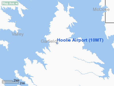
Location & QuickFacts
| FAA Information Effective: | 2008-09-25 |
| Airport Identifier: | 10MT |
| Airport Status: | Operational |
| Longitude/Latitude: | 106-29-02.1440W/47-50-00.0420N
-106.483929/47.833345 (Estimated) |
| Elevation: | 2526 ft / 769.92 m (Surveyed) |
| Land: | 0 acres |
| From nearest city: | 4 nautical miles NW of Haxby, MT |
| Location: | Garfield County, MT |
| Magnetic Variation: | 14E (1985) |
Owner & Manager
| Ownership: | Privately owned |
| Owner: | Hoolie Edwards |
| Address: |
Jordan, MT 59337 |
| Phone number: | 406-557-2578 |
| Manager: | Hoolie Edwards |
| Address: |
Jordan, MT 59337 |
| Phone number: | 406-557-2578 |
Airport Operations and Facilities
| Airport Use: | Private |
| Wind indicator: | No |
| Segmented Circle: | No |
| Control Tower: | No |
| Landing fee charge: | No |
| Sectional chart: | Billings |
| Region: | ANM - Northwest Mountain |
| Boundary ARTCC: | ZLC - Salt Lake City |
| Tie-in FSS: | GTF - Great Falls |
| FSS on Airport: | No |
| FSS Toll Free: | 1-800-WX-BRIEF |
Airport Services
| Airframe Repair: | NONE |
| Power Plant Repair: | NONE |
| Bottled Oxygen: | NONE |
| Bulk Oxygen: | NONE |
Runway Information
Runway E/W
| Dimension: | 1500 x 60 ft / 457.2 x 18.3 m |
| Surface: | TURF, |
| |
Runway E |
Runway W |
| Traffic Pattern: | Left | Left |
| Runway End Identifier: | No | No |
| Centerline Lights: | No | No |
| Touchdown Lights: | No | No |
|
Runway N/S
| Dimension: | 2000 x 60 ft / 609.6 x 18.3 m |
| Surface: | TURF, |
| |
Runway N |
Runway S |
| Traffic Pattern: | Left | Left |
| Runway End Identifier: | No | No |
| Centerline Lights: | No | No |
| Touchdown Lights: | No | No |
|
Runway NW/SE
| Dimension: | 1600 x 60 ft / 487.7 x 18.3 m |
| Surface: | TURF, |
| |
Runway NW |
Runway SE |
| Traffic Pattern: | Left | Left |
| Runway End Identifier: | No | No |
| Centerline Lights: | No | No |
| Touchdown Lights: | No | No |
|
Radio Navigation Aids
| ID |
Type |
Name |
Ch |
Freq |
Var |
Dist |
| MKR | NDB | Milk River | | 339.00 | 14E | 23.2 nm |
| JDN | NDB | Jordan | | 263.00 | 16E | 35.2 nm |
| OLF | NDB | Wolf Point | | 404.00 | 11E | 39.1 nm |
| CRR | NDB | Circle | | 245.00 | 15E | 45.0 nm |
| GGW | VOR/DME | Glasgow | 086X | 113.90 | 14E | 23.7 nm |
Images and information placed above are from
http://www.airport-data.com/airport/10MT/
We thank them for the data!
| General Info
|
| Country |
United States
|
| State |
MONTANA
|
| FAA ID |
10MT
|
| Latitude |
47-50-00.042N
|
| Longitude |
106-29-02.144W
|
| Elevation |
2526 feet
|
| Near City |
HAXBY
|
We don't guarantee the information is fresh and accurate. The data may
be wrong or outdated.
For more up-to-date information please refer to other sources.
|
|


