 |
|
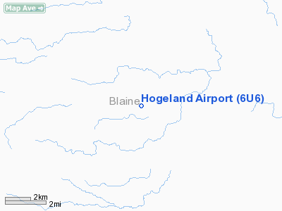
Location & QuickFacts
| FAA Information Effective: | 2008-09-25 |
| Airport Identifier: | 6U6 |
| Airport Status: | Operational |
| Longitude/Latitude: | 108-39-33.5260W/48-51-32.0200N
-108.659313/48.858894 (Estimated) |
| Elevation: | 3138 ft / 956.46 m (Surveyed) |
| Land: | 20 acres |
| From nearest city: | 1 nautical miles NW of Hogeland, MT |
| Location: | Blaine County, MT |
| Magnetic Variation: | 16E (1985) |
Owner & Manager
| Ownership: | Publicly owned |
| Owner: | Blaine County |
| Address: | County Courthouse
Chinook, MT 59523 |
| Phone number: | 406-357-3250 |
| Manager: | Ted Olszewski |
| Address: | 1570 Poland Rd.
Hogeland, MT 59529 |
| Phone number: | 406-379-2582 |
Airport Operations and Facilities
| Airport Use: | Open to public |
| Wind indicator: | Yes |
| Segmented Circle: | No |
| Control Tower: | No |
| Lighting Schedule: | DUSK-DAWN |
| Beacon Color: | Clear-Green (lighted land airport)
ARPT BCN OTS INDEFLY. |
| Landing fee charge: | No |
| Sectional chart: | Billings |
| Region: | ANM - Northwest Mountain |
| Boundary ARTCC: | ZLC - Salt Lake City |
| Tie-in FSS: | GTF - Great Falls |
| FSS on Airport: | No |
| FSS Toll Free: | 1-800-WX-BRIEF |
| NOTAMs Facility: | GTF (NOTAM-d service avaliable) |
Airport Communications
Airport Services
| Airframe Repair: | NONE |
| Power Plant Repair: | NONE |
| Bottled Oxygen: | NONE |
| Bulk Oxygen: | NONE |
Runway Information
Runway 07/25
| Dimension: | 3140 x 60 ft / 957.1 x 18.3 m |
| Surface: | TREATED, Good Condition |
| Edge Lights: | Low
07/25 LIRL OTS INDEFLY. |
| |
Runway 07 |
Runway 25 |
| Traffic Pattern: | Left | Left |
| Obstruction: | , 50:1 slope to clear | 17 ft road, 393.0 ft from runway, 23:1 slope to clear |
|
Runway 16/34
| Dimension: | 1230 x 50 ft / 374.9 x 15.2 m |
| Surface: | TURF, Good Condition |
| |
Runway 16 |
Runway 34 |
| Traffic Pattern: | Left | Left |
| Obstruction: | 17 ft road, 43 ft left of centerline | 21 ft bldg, 104.0 ft from runway, 86 ft left of centerline, 4:1 slope to clear |
|
Radio Navigation Aids
| ID |
Type |
Name |
Ch |
Freq |
Var |
Dist |
| MLK | NDB | Malta | | 272.00 | 17E | 41.2 nm |
| LDS | NDB | Leeds | | 389.00 | 16E | 45.0 nm |
| HVR | VOR/DME | Havre | 055X | 111.80 | 16E | 48.0 nm |
Remarks
- RY 16/34 FOR EMERGENCY USE ONLY; ROAD & DRAINAGE DITCH PARALLEL RY ON EAST SIDE.
Images and information placed above are from
http://www.airport-data.com/airport/6U6/
We thank them for the data!
| General Info
|
| Country |
United States
|
| State |
MONTANA
|
| FAA ID |
6U6
|
| Latitude |
48-51-32.020N
|
| Longitude |
108-39-33.526W
|
| Elevation |
3138 feet
|
| Near City |
HOGELAND
|
We don't guarantee the information is fresh and accurate. The data may
be wrong or outdated.
For more up-to-date information please refer to other sources.
|
|


