 |
|
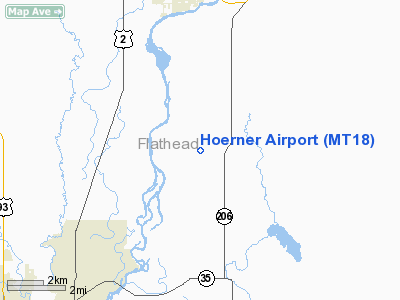
Location & QuickFacts
| FAA Information Effective: | 2008-09-25 |
| Airport Identifier: | MT18 |
| Airport Status: | Operational |
| Longitude/Latitude: | 114-10-58.3200W/48-17-23.8200N
-114.182867/48.289950 (Estimated) |
| Elevation: | 3078 ft / 938.17 m (Estimated) |
| Land: | 0 acres |
| From nearest city: | 7 nautical miles S of Columbia Falls, MT |
| Location: | Flathead County, MT |
| Magnetic Variation: | () |
Owner & Manager
| Ownership: | Privately owned |
| Owner: | David J Hoerner |
| Address: | 298 Gosney Cross Road
Columbia Falls, MT 59912 |
| Phone number: | 406-250-6248 |
| Manager: | David J Hoerner |
| Address: | 298 Gosney Cross Road
Columbia Falls, MT 59912 |
| Phone number: | 406-250-6248 |
Airport Operations and Facilities
| Airport Use: | Private |
| Wind indicator: | Yes |
| Control Tower: | No |
| Sectional chart: | Great Falls |
| Region: | ANM - Northwest Mountain |
| Boundary ARTCC: | ZLC - Salt Lake City |
| Tie-in FSS: | GTF - Great Falls |
| FSS Toll Free: | 1-800-WX-BRIEF |
Runway Information
Runway 09/27
| Dimension: | 1300 x 30 ft / 396.2 x 9.1 m |
| Surface: | TURF, |
| |
Runway 09 |
Runway 27 |
| Traffic Pattern: | Left | Left |
|
Runway 18/36
| Dimension: | 900 x 30 ft / 274.3 x 9.1 m |
| Surface: | TURF, |
| |
Runway 18 |
Runway 36 |
| Traffic Pattern: | Left | Left |
|
Radio Navigation Aids
| ID |
Type |
Name |
Ch |
Freq |
Var |
Dist |
| SAK | NDB | Smith Lake | | 515.00 | 18E | 15.6 nm |
| PLS | NDB | Polson | | 275.00 | 20E | 35.7 nm |
| FCA | VOR/DME | Kalispell | 079X | 113.20 | 18E | 4.6 nm |
Remarks
- MNTN COMM WITH GPI ATCT DURG IFR CONDS.
- PRVD VFR OPNS, PVT USE, AND MNTN COMMS WITH GPI ATCT DURG IFR CONDS.
Images and information placed above are from
http://www.airport-data.com/airport/MT18/
We thank them for the data!
We don't guarantee the information is fresh and accurate. The data may
be wrong or outdated.
For more up-to-date information please refer to other sources.
|
|


