 |
|
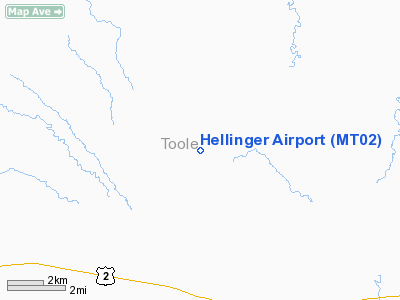
Location & QuickFacts
| FAA Information Effective: | 2008-09-25 |
| Airport Identifier: | MT02 |
| Airport Status: | Operational |
| Longitude/Latitude: | 111-29-51.0030W/48-32-17.9580N
-111.497501/48.538322 (Estimated) |
| Elevation: | 3215 ft / 979.93 m (Surveyed) |
| Land: | 0 acres |
| From nearest city: | 4 nautical miles N of Devon, MT |
| Location: | Toole County, MT |
| Magnetic Variation: | 17E (1985) |
Owner & Manager
| Ownership: | Privately owned |
| Owner: | Donald R Hellinger |
| Address: | Devon Star Rte
Shelby, MT 59474 |
| Phone number: | 406-432-3261 |
| Manager: | Donald R Hellinger |
| Address: | Devon Star Rte
Shelby, MT 59474 |
| Phone number: | 406-432-3261 |
Airport Operations and Facilities
| Airport Use: | Private |
| Wind indicator: | Yes |
| Segmented Circle: | No |
| Control Tower: | No |
| Lighting Schedule: | PHONE REQ
FOR LIRL RY E/W CALL 406-432-3261. |
| Landing fee charge: | No |
| Sectional chart: | Great Falls |
| Region: | ANM - Northwest Mountain |
| Boundary ARTCC: | ZLC - Salt Lake City |
| Tie-in FSS: | GTF - Great Falls |
| FSS on Airport: | No |
| FSS Toll Free: | 1-800-WX-BRIEF |
Airport Services
| Airframe Repair: | NONE |
| Power Plant Repair: | NONE |
Runway Information
Runway E/W
| Dimension: | 2600 x 75 ft / 792.5 x 22.9 m |
| Surface: | TURF, |
| Edge Lights: | Low |
| |
Runway E |
Runway W |
| Traffic Pattern: | Right | Left |
|
Runway NE/SW
| Dimension: | 2400 x 75 ft / 731.5 x 22.9 m |
| Surface: | TURF, |
| |
Runway NE |
Runway SW |
| Traffic Pattern: | Left | Left |
|
Runway NW/SE
| Dimension: | 2600 x 75 ft / 792.5 x 22.9 m |
| Surface: | TURF, |
| |
Runway NW |
Runway SE |
| Traffic Pattern: | Left | Left |
|
Radio Navigation Aids
| ID |
Type |
Name |
Ch |
Freq |
Var |
Dist |
| SBX | NDB | Shelby | | 347.00 | 18E | 14.5 nm |
| LTY | NDB | Chester | | 323.00 | 15E | 20.6 nm |
| CRD | NDB | Conrad | | 293.00 | 17E | 27.0 nm |
| CTB | VORTAC | Cut Bank | 091X | 114.40 | 17E | 33.7 nm |
Images and information placed above are from
http://www.airport-data.com/airport/MT02/
We thank them for the data!
| General Info
|
| Country |
United States
|
| State |
MONTANA
|
| FAA ID |
MT02
|
| Latitude |
48-32-17.958N
|
| Longitude |
111-29-51.003W
|
| Elevation |
3215 feet
|
| Near City |
DEVON
|
We don't guarantee the information is fresh and accurate. The data may
be wrong or outdated.
For more up-to-date information please refer to other sources.
|
|


