|
|
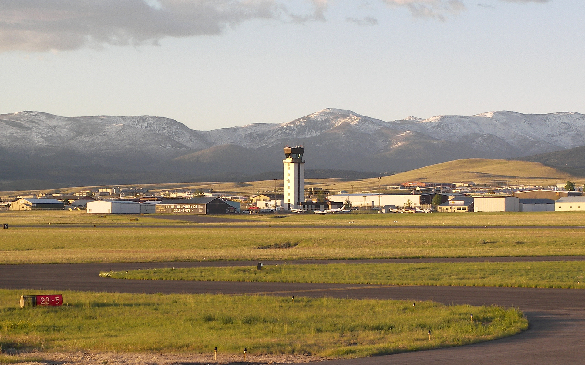
| Helena Regional Airport |
 |
| IATA: HLN – ICAO: KHLN – FAA LID: HLN |
| Summary |
| Airport type |
Public |
| Operator |
Helena Regional Airport Authority |
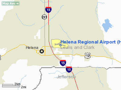
| Location |
Helena, Montana |
| Elevation AMSL |
3,877 ft / 1,181.7 m |
| Coordinates |
46°36′24.5″N 111°58′57.9″W / 46.606806°N 111.98275°W / 46.606806; -111.98275Coordinates: 46°36′24.5″N 111°58′57.9″W / 46.606806°N 111.98275°W / 46.606806; -111.98275 |
| Runways |
| Direction |
Length |
Surface |
| ft |
m |
| 9/27 |
9,000 |
2,743 |
Asphalt |
| 5/23 |
4,644 |
1,415 |
Asphalt |
| 16/34 |
2,989 |
911 |
Asphalt |
Helena Regional Airport (IATA: HLN, ICAO: KHLN, FAA LID: HLN) is a public airport located two miles (3 km) northeast of the city of Helena in Lewis and Clark County, Montana, United States. The airport has three runways.
Airlines & Destinations
| Airlines |
Destinations |
| Delta Connection operated by Mesaba Airlines |
Minneapolis/St. Paul |
| Delta Connection operated by SkyWest Airlines |
Salt Lake City |
| Horizon Air |
Seattle/Tacoma |
| United Express operated by SkyWest Airlines |
Denver |
The above content comes from Wikipedia and is published under free licenses – click here to read more.
Location & QuickFacts
| FAA Information Effective: | 2008-09-25 |
| Airport Identifier: | HLN |
| Airport Status: | Operational |
| Longitude/Latitude: | 111-58-57.9000W/46-36-24.5000N
-111.982750/46.606806 (Estimated) |
| Elevation: | 3877 ft / 1181.71 m (Surveyed) |
| Land: | 1224 acres |
| From nearest city: | 2 nautical miles NE of Helena, MT |
| Location: | Lewis And Clark County, MT |
| Magnetic Variation: | 16E (1990) |
Owner & Manager
| Ownership: | Publicly owned |
| Owner: | Helena Reg Arpt Auth |
| Address: | 2850 Skyway Dr
Helena, MT 59601 |
| Phone number: | 406-442-2821 |
| Manager: | Ron Mercer |
| Address: | 2850 Skyway Dr
Helena, MT 59601 |
| Phone number: | 406-442-2821 |
Airport Operations and Facilities
| Airport Use: | Open to public |
| Wind indicator: | Yes |
| Segmented Circle: | Yes |
| Control Tower: | Yes |
| Lighting Schedule: | DUSK-DAWN
WHEN ATCT CLSD ACTVT HIRL RY 09/27, MIRL RYS 05/23 & 16/34, REIL RY 09, MALSR RY 27 - CTAF. |
| Beacon Color: | Clear-Green (lighted land airport) |
| Landing fee charge: | Yes
LNDG FEE FOR ALL COMMERCIAL ACFT & ALL ACFT OVER 10000 LBS. |
| Sectional chart: | Great Falls |
| Region: | ANM - Northwest Mountain |
| Boundary ARTCC: | ZLC - Salt Lake City |
| Tie-in FSS: | GTF - Great Falls |
| FSS on Airport: | No |
| FSS Toll Free: | 1-800-WX-BRIEF |
| NOTAMs Facility: | HLN (NOTAM-d service avaliable) |
| Certification type/date: | I B S 05/1973
ARFF COVERAGE PRVDD FOR SKED PART 121 ACRS ONLY EXCP WITH PRIOR APPROVAL - CALL 406-442-2821. |
| Federal Agreements: | NGY3 |
Airport Communications
| CTAF: | 118.300 |
| Unicom: | 122.950 |
Airport Services
| Fuel available: | 100 100LL80 A |
| Airframe Repair: | MAJOR |
| Power Plant Repair: | MAJOR |
| Bottled Oxygen: | HIGH |
| Bulk Oxygen: | HIGH |
Runway Information
Runway 05/23
| Dimension: | 4644 x 75 ft / 1415.5 x 22.9 m |
| Surface: | ASPH, Good Condition |
| Surface Treatment: | Porous Friction Course |
| Weight Limit: | Single wheel: 21000 lbs.
Dual wheel: 30000 lbs. |
| Edge Lights: | Medium |
| |
Runway 05 |
Runway 23 |
| Longitude: | 111-59-50.7947W | 111-58-49.9355W |
| Latitude: | 46-36-20.1561N | 46-36-38.6139N |
| Elevation: | 3877.00 ft | 3820.00 ft |
| Alignment: | 66 | 127 |
| Traffic Pattern: | Left | Right |
| Markings: | Basic, Good Condition | Basic, Good Condition |
| Crossing Height: | 0.00 ft | 40.00 ft |
| VASI: | | 2-light PAPI on left side |
| Visual Glide Angle: | 0.00° | 3.00° |
| Obstruction: | 22 ft road, 425.0 ft from runway, 136 ft left of centerline, 10:1 slope to clear | 8 ft fence, 550.0 ft from runway, 165 ft left of centerline, 43:1 slope to clear |
|
Runway 09/27
| Dimension: | 9000 x 150 ft / 2743.2 x 45.7 m |
| Surface: | ASPH, Good Condition |
| Surface Treatment: | Porous Friction Course |
| Weight Limit: | Single wheel: 100000 lbs.
Dual wheel: 160000 lbs.
Dual tandem wheel: 250000 lbs. |
| Edge Lights: | High |
| |
Runway 09 |
Runway 27 |
| Longitude: | 111-59-51.6790W | 111-57-45.9565W |
| Latitude: | 46-36-30.2887N | 46-36-10.7599N |
| Elevation: | 3864.00 ft | 3845.00 ft |
| Alignment: | 102 | 127 |
| ILS Type: | | ILS
|
| Traffic Pattern: | Left | Right |
| Markings: | Precision instrument, Good Condition | Precision instrument, Good Condition |
| Crossing Height: | 45.00 ft | 55.00 ft |
| VASI: | 4-box on left side | 4-box on left side |
| Visual Glide Angle: | 3.00° | 3.00° |
| Approach lights: | | MALSR |
| Runway End Identifier: | Yes | |
| Obstruction: | 6 ft gnd, 200.0 ft from runway, 350 ft right of centerline
+6' GND 0-200' FM RY END 350' R. | , 50:1 slope to clear |
|
Runway 16/34
| Dimension: | 2989 x 75 ft / 911.0 x 22.9 m |
| Surface: | ASPH, Fair Condition |
| Surface Treatment: | Porous Friction Course |
| Weight Limit: | Single wheel: 21000 lbs.
Dual wheel: 30000 lbs. |
| Edge Lights: | Medium |
| |
Runway 16 |
Runway 34 |
| Longitude: | 111-58-50.7830W | 111-58-50.2909W |
| Latitude: | 46-36-43.8226N | 46-36-14.3266N |
| Elevation: | 3812.00 ft | 3862.00 ft |
| Alignment: | 127 | 127 |
| Traffic Pattern: | Left | Right |
| Markings: | Basic, Good Condition | Basic, Good Condition |
| Obstruction: | , 50:1 slope to clear | 4 ft gnd, 200.0 ft from runway
+4' GND 0-200' FM RY END 0-125' L & R. |
|
Radio Navigation Aids
| ID |
Type |
Name |
Ch |
Freq |
Var |
Dist |
| CVP | NDB | Capitol | | 335.00 | 16E | 1.9 nm |
| HAU | NDB | Hauser | | 386.00 | 16E | 9.6 nm |
| DRU | VOR | Drummond | | 117.10 | 17E | 49.7 nm |
| CPN | VOR/DME | Coppertown | 053X | 111.60 | 16E | 46.9 nm |
| HLN | VORTAC | Helena | 124X | 117.70 | 16E | 1.2 nm |
| HIA | VORTAC | Whitehall | 084X | 113.70 | 18E | 45.4 nm |
Remarks
- FLIGHT NOTIFICATION SERVICE (ADCUS) AVBL.
- RY 16/34 & RY 05/23 (EXCP BTN TWY F & RY 09/27) NOT AVBL FOR AIR CARRIER USE BY ACFT WITH GTR THAN 30 PSGR SEATS.
- TWYS A, B, AND C (BTN TWY A & RY 34) NOT AVBL FOR AIR CARRIER USE BY ACFT WITH GTR THAN 30 PSGR SEATS.
- ARNG - OPR 1400-0030Z++ MON-FRI, EXC HOL. EXERCISE CAUTION WHILE TAXIING, AASF RAMP NOT STRESSED FOR LARGE ACFT. CTC FLT OPS FOR RAMP ADVSY 126.2, DSN 324-3055/56, C406-324-3055/56. NO TRANS SVC SAT, SUN, HOL OR AFTER 2300Z++ MON-FRI.
- FUEL - A, J8 (C406-442-2190. SVC FEE $50.) (NC-80, 100, 100LL)
Images and information placed above are from
http://www.airport-data.com/airport/HLN/
We thank them for the data!
| General Info
|
| Country |
United States
|
| State |
MONTANA
|
| FAA ID |
HLN
|
| Latitude |
46-36-24.545N
|
| Longitude |
111-58-57.901W
|
| Elevation |
3874 feet
|
| Near City |
HELENA
|
We don't guarantee the information is fresh and accurate. The data may
be wrong or outdated.
For more up-to-date information please refer to other sources.
|
|