 |
|
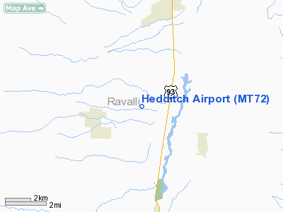
Location & QuickFacts
| FAA Information Effective: | 2008-09-25 |
| Airport Identifier: | MT72 |
| Airport Status: | Operational |
| Longitude/Latitude: | 114-10-34.3540W/46-20-45.7190N
-114.176209/46.346033 (Estimated) |
| Elevation: | 3663 ft / 1116.48 m (Estimated) |
| Land: | 40 acres |
| From nearest city: | 3 nautical miles NW of Corvallis, MT |
| Location: | Ravalli County, MT |
| Magnetic Variation: | 17E (1985) |
Owner & Manager
| Ownership: | Privately owned |
| Owner: | David R. Hedditch |
| Address: | 501 Darla Dr.
Victor, MT 59875 |
| Phone number: | 406-360-3283 |
| Manager: | David R. Hedditch |
| Address: | 501 Darla Dr.
Victor, MT 59875 |
| Phone number: | 406-360-3283 |
Airport Operations and Facilities
| Airport Use: | Private |
| Segmented Circle: | No |
| Control Tower: | No |
| Sectional chart: | Great Falls |
| Region: | ANM - Northwest Mountain |
| Boundary ARTCC: | ZLC - Salt Lake City |
| Tie-in FSS: | GTF - Great Falls |
| FSS Toll Free: | 1-800-WX-BRIEF |
Runway Information
Runway 07/25
| Dimension: | 3000 x 80 ft / 914.4 x 24.4 m |
| Surface: | TURF-DIRT, |
| |
Runway 07 |
Runway 25 |
| Traffic Pattern: | Left | Left |
|
Radio Navigation Aids
| ID |
Type |
Name |
Ch |
Freq |
Var |
Dist |
| HMM | NDB | Hamilton | | 410.00 | 19E | 5.6 nm |
| INE | NDB | Konna | | 521.00 | 17E | 45.9 nm |
| DRU | VOR | Drummond | | 117.10 | 17E | 44.5 nm |
| MSO | VOR/DME | Missoula | 075X | 112.80 | 17E | 34.0 nm |
Remarks
Images and information placed above are from
http://www.airport-data.com/airport/MT72/
We thank them for the data!
| General Info
|
| Country |
United States
|
| State |
MONTANA
|
| FAA ID |
MT72
|
| Latitude |
46-20-45.719N
|
| Longitude |
114-10-34.354W
|
| Elevation |
3663 feet
|
| Near City |
CORVALLIS
|
We don't guarantee the information is fresh and accurate. The data may
be wrong or outdated.
For more up-to-date information please refer to other sources.
|
|


