 |
|
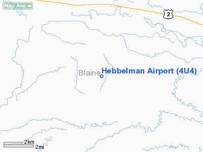
Location & QuickFacts
| FAA Information Effective: | 2008-09-25 |
| Airport Identifier: | 4U4 |
| Airport Status: | Operational |
| Longitude/Latitude: | 109-03-44.6050W/48-30-49.9910N
-109.062390/48.513886 (Estimated) |
| Elevation: | 2576 ft / 785.16 m (Surveyed) |
| Land: | 28 acres |
| From nearest city: | 8 nautical miles SE of Chinook, MT |
| Location: | Blaine County, MT |
| Magnetic Variation: | 16E (1985) |
Owner & Manager
| Ownership: | Privately owned |
| Owner: | John Hebbelman, Jr. |
| Address: | Rt 1 Box 27
Chinook, MT 59523 |
| Phone number: | 406-357-4233 |
| Manager: | John Hebbelman, Jr. |
| Address: | Rt 1 Box 27
Chinook, MT 59523 |
| Phone number: | 406-357-4233 |
Airport Operations and Facilities
| Airport Use: | Open to public |
| Wind indicator: | Yes |
| Segmented Circle: | No |
| Control Tower: | No |
| Lighting Schedule: | PHONE REQ
FOR THLD LIGHTS RY 04/22 CTC AMGR AT 406-357-4233. |
| Landing fee charge: | No |
| Sectional chart: | Great Falls |
| Region: | ANM - Northwest Mountain |
| Boundary ARTCC: | ZLC - Salt Lake City |
| Tie-in FSS: | GTF - Great Falls |
| FSS on Airport: | No |
| FSS Toll Free: | 1-800-WX-BRIEF |
| NOTAMs Facility: | GTF (NOTAM-d service avaliable) |
Airport Communications
| CTAF: | 122.800 |
| Unicom: | 122.800 |
Airport Services
| Fuel available: | 100LL |
| Airframe Repair: | MAJOR |
| Power Plant Repair: | MAJOR |
| Bottled Oxygen: | NONE |
Runway Information
Runway 04/22
| Dimension: | 3650 x 50 ft / 1112.5 x 15.2 m |
| Surface: | TURF-GRVL, Fair Condition
FIRST 1130 FT RY 04 HAS 20 FT GRVL CENTER; REMAINDER TURF. |
| Edge Lights: | Non-standard lighting system
THR LGTS ONLY; NO OTHER LGTS. |
| |
Runway 04 |
Runway 22 |
| Traffic Pattern: | Left | Left |
| Obstruction: | 4 ft fence, 109.0 ft from runway, 27:1 slope to clear | 22 ft pole, 150.0 ft from runway, 75 ft right of centerline, 6:1 slope to clear |
|
Runway 11/29
| Dimension: | 2254 x 55 ft / 687.0 x 16.8 m |
| Surface: | TURF, Fair Condition
FIRST 1130 FT RY 04 HAS 20 FT GRVL CENTER; REMAINDER TURF. |
| |
Runway 11 |
Runway 29 |
| Traffic Pattern: | Left | Left |
| Obstruction: | , 50:1 slope to clear | 4 ft fence, 40.0 ft from runway, 10:1 slope to clear |
|
Radio Navigation Aids
| ID |
Type |
Name |
Ch |
Freq |
Var |
Dist |
| LDS | NDB | Leeds | | 389.00 | 16E | 25.1 nm |
| MLK | NDB | Malta | | 272.00 | 17E | 46.3 nm |
| HVR | VOR/DME | Havre | 055X | 111.80 | 16E | 28.2 nm |
Remarks
- RY 11 HAS ABRUPT GULLEY 20 FT FM END OF RY.
- RY 04 LARGE 8 FT DEEP SINKHOLE IN RGT SIDE OF RY 400 FT FM THLD.
- RY 29 DIRT ROAD CROSSES RY 300 FT BYD THLD.
Images and information placed above are from
http://www.airport-data.com/airport/4U4/
We thank them for the data!
| General Info
|
| Country |
United States
|
| State |
MONTANA
|
| FAA ID |
4U4
|
| Latitude |
48-30-49.991N
|
| Longitude |
109-03-44.605W
|
| Elevation |
2576 feet
|
| Near City |
CHINOOK
|
We don't guarantee the information is fresh and accurate. The data may
be wrong or outdated.
For more up-to-date information please refer to other sources.
|
|


