 |
|
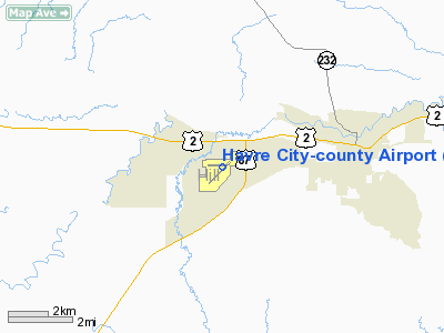
Havre City-county Airport |
| Havre City-County Airport |
| IATA: none – ICAO: KHVR – FAA LID: HVR |
| Summary |
| Airport type |
Public |
| Owner |
City of Havre & Hill County |
| Serves |
Havre, Montana |
| Elevation AMSL |
2,591 ft / 790 m |
| Coordinates |
48°32′35″N 109°45′44″W / 48.54306°N 109.76222°W / 48.54306; -109.76222 |
| Runways |
| Direction |
Length |
Surface |
| ft |
m |
| 8/26 |
5,205 |
1,586 |
Asphalt |
| 3/21 |
3,699 |
1,127 |
Asphalt |
| Statistics (2009) |
| Aircraft operations |
7,994 |
| Based aircraft |
27 |
| Source: Federal Aviation Administration |
Havre City-County Airport (IATA: HVR, ICAO: KHVR, FAA LID: HVR) is a public-use airport located three nautical miles (6 km) west of the central business district of Havre, a city in Hill County, Montana, United States. It is owned by the City of Havre and Hill County. This airport is included in the FAA's National Plan of Integrated Airport Systems for 2009–2013, which categorized it as a general aviation facility. It is also served by one commercial airline.
Scheduled air service at Havre temporarily ceased on March 8, 2008, when Big Sky Airlines ended operations in bankruptcy. Great Lakes Airlines won the USDOT contract to take over Essential Air Service between Havre and Billings, Montana, and flights began February 1, 2009. Facilities and aircraft
Havre City-County Airport covers an area of 720 acres (291 ha) at an elevation of 2,591 feet (790 m) above mean sea level. It has two asphalt paved runways: 8/26 is 5,205 by 100 feet (1,586 x 30 m) and 3/21 is 3,699 by 60 feet (1,127 x 18 m).
For the 12-month period ending December 31, 2009, the airport had 7,994 aircraft operations, an average of 21 per day: 85% general aviation, 14% air taxi, and 1% military. At that time there were 27 aircraft based at this airport: 96% single-engine and 4% multi-engine.
Airlines and destinations
| Airlines |
Destinations |
| Great Lakes Airlines |
Billings, Denver, Lewistown |
The above content comes from Wikipedia and is published under free licenses – click here to read more.
Location & QuickFacts
| FAA Information Effective: | 2008-09-25 |
| Airport Identifier: | HVR |
| Airport Status: | Operational |
| Longitude/Latitude: | 109-45-44.4000W/48-32-34.7000N
-109.762333/48.542972 (Estimated) |
| Elevation: | 2591 ft / 789.74 m (Surveyed) |
| Land: | 720 acres |
| From nearest city: | 3 nautical miles W of Havre, MT |
| Location: | Hill County, MT |
| Magnetic Variation: | 16E (1985) |
Owner & Manager
| Ownership: | Publicly owned |
| Owner: | City Of Havre & Hill Co |
| Address: | 520 4 Th St, Po Box 231
Havre, MT 59501 |
| Phone number: | 406-265-4671 |
| Manager: | Bill Arvin |
| Address: | 5404 9th St West
Havre, MT 59501 |
| Phone number: | 406-265-5146 |
Airport Operations and Facilities
| Airport Use: | Open to public |
| Wind indicator: | Yes |
| Segmented Circle: | Yes |
| Control Tower: | No |
| Lighting Schedule: | DUSK-DAWN
ACTVT MIRL RY 03/21, REIL RYS 07 & 25, VASI RYS 07 & 25, & PAPI RY 21 - CTAF. |
| Beacon Color: | Clear-Green (lighted land airport) |
| Landing fee charge: | No |
| Sectional chart: | Great Falls |
| Region: | ANM - Northwest Mountain |
| Boundary ARTCC: | ZLC - Salt Lake City |
| Tie-in FSS: | GTF - Great Falls |
| FSS on Airport: | No |
| FSS Toll Free: | 1-800-WX-BRIEF |
| NOTAMs Facility: | HVR (NOTAM-d service avaliable) |
| Certification type/date: | III A S 10/20 |
| Federal Agreements: | NGY3 |
Airport Communications
| CTAF: | 122.800 |
| Unicom: | 122.800 |
Airport Services
| Fuel available: | 100LLA |
| Airframe Repair: | MAJOR |
| Power Plant Repair: | MAJOR |
| Bottled Oxygen: | NONE |
| Bulk Oxygen: | NONE |
Runway Information
Runway 03/21
| Dimension: | 3699 x 60 ft / 1127.5 x 18.3 m |
| Surface: | ASPH, Good Condition |
| Weight Limit: | Single wheel: 12500 lbs. |
| Edge Lights: | Medium |
| |
Runway 03 |
Runway 21 |
| Longitude: | 109-46-05.4355W | 109-45-26.5354W |
| Latitude: | 48-32-16.4910N | 48-32-42.2748N |
| Elevation: | 2590.00 ft | 2583.00 ft |
| Alignment: | 45 | 127 |
| Traffic Pattern: | Left | Left |
| Markings: | Basic, Good Condition | Basic, Good Condition |
| Crossing Height: | 0.00 ft | 22.00 ft |
| VASI: | | 2-light PAPI on right side |
| Visual Glide Angle: | 0.00° | 3.00° |
| Obstruction: | , 50:1 slope to clear | 57 ft hill, 2500.0 ft from runway, 355 ft right of centerline, 40:1 slope to clear |
|
Runway 07/25
| Dimension: | 5205 x 100 ft / 1586.5 x 30.5 m |
| Surface: | ASPH, Good Condition |
| Weight Limit: | Single wheel: 50000 lbs.
Dual wheel: 50000 lbs.
Dual tandem wheel: 75000 lbs. |
| Edge Lights: | Medium |
| |
Runway 07 |
Runway 25 |
| Longitude: | 109-46-21.9793W | 109-45-04.6365W |
| Latitude: | 48-32-38.5633N | 48-32-38.5144N |
| Elevation: | 2581.00 ft | 2580.00 ft |
| Alignment: | 90 | 127 |
| Traffic Pattern: | Left | Left |
| Markings: | Non-precision instrument, Fair Condition | Non-precision instrument, Fair Condition |
| Crossing Height: | 40.00 ft | 37.00 ft |
| VASI: | 4-box on left side | 4-box on left side |
| Visual Glide Angle: | 3.00° | 3.00° |
| Runway End Identifier: | Yes | Yes |
| Obstruction: | , 50:1 slope to clear | 22 ft road, 1109.0 ft from runway, 41:1 slope to clear
+3' FENCE, 200 FT FROM RY END, 144' LEFT. |
|
Radio Navigation Aids
| ID |
Type |
Name |
Ch |
Freq |
Var |
Dist |
| LDS | NDB | Leeds | | 389.00 | 16E | 2.9 nm |
| LTY | NDB | Chester | | 323.00 | 15E | 48.6 nm |
| HVR | VOR/DME | Havre | 055X | 111.80 | 16E | 0.3 nm |
Remarks
- POTENTIAL LARGE FLOCKS OF WATERFOWL NEAR APPROACH END RY 25.
Images and information placed above are from
http://www.airport-data.com/airport/HVR/
We thank them for the data!
| General Info
|
| Country |
United States
|
| State |
MONTANA
|
| FAA ID |
HVR
|
| Latitude |
48-32-34.746N
|
| Longitude |
109-45-44.431W
|
| Elevation |
2590 feet
|
| Near City |
HAVRE
|
We don't guarantee the information is fresh and accurate. The data may
be wrong or outdated.
For more up-to-date information please refer to other sources.
|
|


