 |
|
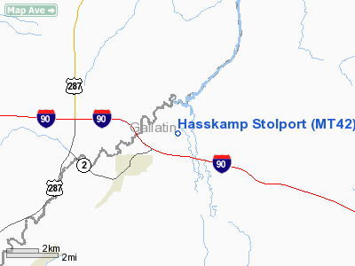
Location & QuickFacts
| FAA Information Effective: | 2008-09-25 |
| Airport Identifier: | MT42 |
| Airport Status: | Operational |
| Longitude/Latitude: | 111-30-49.8880W/45-54-37.7410N
-111.513858/45.910484 (Estimated) |
| Elevation: | 4052 ft / 1235.05 m (Estimated) |
| Land: | 12 acres |
| From nearest city: | 2 nautical miles NE of Three Forks, MT |
| Location: | Gallatin County, MT |
| Magnetic Variation: | 16E (1985) |
Owner & Manager
| Ownership: | Privately owned |
| Owner: | Fred W. Hasskamp |
| Address: | 115 Central Ave
Hamilton, MT 59840-2821 |
| Phone number: | 406-363-1742 |
| Manager: | Fred W. Hasskamp |
| Address: | 115 Central Ave
Hamilton, MT 59840-2821 |
| Phone number: | 406-363-1742 |
Airport Operations and Facilities
| Airport Use: | Private
PERSONAL USE. |
| Wind indicator: | Yes |
| Segmented Circle: | No |
| Control Tower: | No |
| Sectional chart: | Great Falls |
| Region: | ANM - Northwest Mountain |
| Boundary ARTCC: | ZLC - Salt Lake City |
| Tie-in FSS: | GTF - Great Falls |
| FSS on Airport: | No |
| FSS Toll Free: | 1-800-WX-BRIEF |
Runway Information
Runway 14/32
| Dimension: | 1225 x 50 ft / 373.4 x 15.2 m |
| Surface: | TURF, Poor Condition
NOT MOWED REGULARLY; TALL GRASS; POSSIBLE FLOODING. |
| |
Runway 14 |
Runway 32 |
| Traffic Pattern: | Left | Left |
| Obstruction: | | 3 ft fence, 30.0 ft from runway |
|
Radio Navigation Aids
| ID |
Type |
Name |
Ch |
Freq |
Var |
Dist |
| EKS | NDB | Ennis | | 286.00 | 15E | 39.2 nm |
| HAU | NDB | Hauser | | 386.00 | 16E | 40.9 nm |
| CVP | NDB | Capitol | | 335.00 | 16E | 45.4 nm |
| BZN | VOR/DME | Bozeman | 071X | 112.40 | 18E | 16.8 nm |
| HIA | VORTAC | Whitehall | 084X | 113.70 | 18E | 27.6 nm |
| HLN | VORTAC | Helena | 124X | 117.70 | 16E | 45.7 nm |
| LVM | VORTAC | Livingston | 108X | 116.10 | 15E | 46.6 nm |
Remarks
- LAND RY 14; TKOF RY 32.
- UNMKD PLINE SE OF ARPT.
- RY 32 APCH RATIO 14:1.
Images and information placed above are from
http://www.airport-data.com/airport/MT42/
We thank them for the data!
| General Info
|
| Country |
United States
|
| State |
MONTANA
|
| FAA ID |
MT42
|
| Latitude |
45-54-37.741N
|
| Longitude |
111-30-49.888W
|
| Elevation |
4052 feet
|
| Near City |
THREE FORKS
|
We don't guarantee the information is fresh and accurate. The data may
be wrong or outdated.
For more up-to-date information please refer to other sources.
|
|


