 |
|
Location & QuickFacts
| FAA Information Effective: | 2008-09-25 |
| Airport Identifier: | 48S |
| Airport Status: | Operational |
| Longitude/Latitude: | 108-46-24.4000W/48-33-57.9000N
-108.773444/48.566083 (Estimated) |
| Elevation: | 2643 ft / 805.59 m (Estimated) |
| Land: | 237 acres |
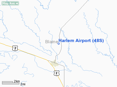
| From nearest city: | 3 nautical miles N of Harlem, MT |
| Location: | Blaine County, MT |
| Magnetic Variation: | 16E (1985) |
Owner & Manager
| Ownership: | Publicly owned |
| Owner: | Blaine Co-city Of Harlem |
| Address: | Blaine County Arpt Cmsn
Chinook, MT 59523 |
| Phone number: | 406-357-3250 |
| Manager: | Tom Parnell
ADDNL PHONE CLARENCE OLSON 353-2242/2470 FM 0800-1800. |
| Address: | Box 427
Harlem, MT 59526 |
| Phone number: | 406-353-2305 |
Airport Operations and Facilities
| Airport Use: | Open to public |
| Wind indicator: | Yes |
| Segmented Circle: | Yes |
| Control Tower: | No |
| Lighting Schedule: | DUSK-DAWN
ACTVT MIRL RY 11/29 & PAPI RY 29 - CTAF. |
| Beacon Color: | Clear-Green (lighted land airport) |
| Landing fee charge: | No |
| Sectional chart: | Billings |
| Region: | ANM - Northwest Mountain |
| Boundary ARTCC: | ZLC - Salt Lake City |
| Tie-in FSS: | GTF - Great Falls |
| FSS on Airport: | No |
| FSS Toll Free: | 1-800-WX-BRIEF |
| NOTAMs Facility: | GTF (NOTAM-d service avaliable) |
| Federal Agreements: | NGY |
Airport Communications
Airport Services
| Airframe Repair: | NONE |
| Power Plant Repair: | NONE |
| Bottled Oxygen: | NONE |
| Bulk Oxygen: | NONE |
Runway Information
Runway 11/29
| Dimension: | 4100 x 75 ft / 1249.7 x 22.9 m |
| Surface: | ASPH, Good Condition
RWY 15/33 HAS LARGE GOPHER HOLES THROUGHOUT. |
| Weight Limit: | Single wheel: 12500 lbs. |
| Edge Lights: | Medium |
| |
Runway 11 |
Runway 29 |
| Longitude: | 108-46-55.3800W | 108-46-05.3000W |
| Latitude: | 48-34-20.2600N | 48-33-57.2000N |
| Elevation: | 2643.00 ft | 2600.00 ft |
| Alignment: | 125 | 127 |
| Traffic Pattern: | Left | Left |
| Markings: | Basic, Good Condition | Basic, Good Condition |
| Crossing Height: | 0.00 ft | 32.00 ft |
| VASI: | | 2-light PAPI on left side |
| Visual Glide Angle: | 0.00° | 3.00° |
| Obstruction: | , 50:1 slope to clear | 15 ft road, 550.0 ft from runway, 310 ft right of centerline, 23:1 slope to clear |
|
Runway 15/33
| Dimension: | 1942 x 120 ft / 591.9 x 36.6 m |
| Surface: | TURF, Fair Condition
RWY 15/33 HAS LARGE GOPHER HOLES THROUGHOUT. |
| |
Runway 15 |
Runway 33 |
| Traffic Pattern: | Left | Left |
|
Radio Navigation Aids
| ID |
Type |
Name |
Ch |
Freq |
Var |
Dist |
| MLK | NDB | Malta | | 272.00 | 17E | 35.8 nm |
| LDS | NDB | Leeds | | 389.00 | 16E | 36.5 nm |
| HVR | VOR/DME | Havre | 055X | 111.80 | 16E | 39.7 nm |
Images and information placed above are from
http://www.airport-data.com/airport/48S/
We thank them for the data!
| General Info
|
| Country |
United States
|
| State |
MONTANA
|
| FAA ID |
48S
|
| Latitude |
48-33-59.993N
|
| Longitude |
108-46-22.562W
|
| Elevation |
2623 feet
|
| Near City |
HARLEM
|
We don't guarantee the information is fresh and accurate. The data may
be wrong or outdated.
For more up-to-date information please refer to other sources.
|
|


