 |
|
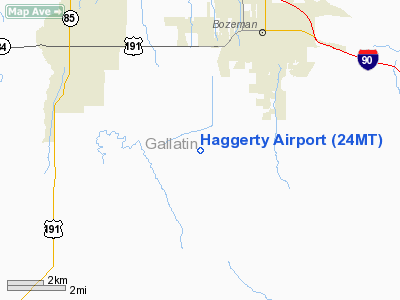
Location & QuickFacts
| FAA Information Effective: | 2008-09-25 |
| Airport Identifier: | 24MT |
| Airport Status: | Operational |
| Longitude/Latitude: | 111-05-31.9000W/45-37-09.7200N
-111.092194/45.619367 (Estimated) |
| Elevation: | 5170 ft / 1575.82 m (Estimated) |
| Land: | 40 acres |
| From nearest city: | 4 nautical miles SW of Bozeman, MT |
| Location: | Gallatin County, MT |
| Magnetic Variation: | () |
Owner & Manager
| Ownership: | Privately owned |
| Owner: | Kevin Haggerty |
| Address: | 5100 Patterson Rd
Bozeman, MT 59718 |
| Phone number: | 406-585-9868 |
| Manager: | Kevin Haggerty |
| Address: | 5100 Patterson Rd
Bozeman, MT 59718 |
| Phone number: | 406-585-9868 |
Airport Operations and Facilities
| Airport Use: | Private |
| Wind indicator: | Yes |
| Control Tower: | No |
| Sectional chart: | Great Falls |
| Region: | ANM - Northwest Mountain |
| Boundary ARTCC: | ZLC - Salt Lake City |
| Tie-in FSS: | GTF - Great Falls |
| FSS Toll Free: | 1-800-WX-BRIEF |
Runway Information
Runway 17/35
| Dimension: | 2600 x 50 ft / 792.5 x 15.2 m |
| Surface: | TURF, |
| |
Runway 17 |
Runway 35 |
| Traffic Pattern: | Left | Left |
| Obstruction: | 70 ft pline, 700.0 ft from runway | 5 ft fence, 50.0 ft from runway |
|
Radio Navigation Aids
| ID |
Type |
Name |
Ch |
Freq |
Var |
Dist |
| EKS | NDB | Ennis | | 286.00 | 15E | 31.7 nm |
| BZN | VOR/DME | Bozeman | 071X | 112.40 | 18E | 10.2 nm |
| LVM | VORTAC | Livingston | 108X | 116.10 | 15E | 27.7 nm |
| HIA | VORTAC | Whitehall | 084X | 113.70 | 18E | 47.5 nm |
Remarks
Images and information placed above are from
http://www.airport-data.com/airport/24MT/
We thank them for the data!
We don't guarantee the information is fresh and accurate. The data may
be wrong or outdated.
For more up-to-date information please refer to other sources.
|
|


