 |
|
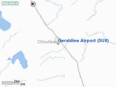
Location & QuickFacts
| FAA Information Effective: | 2008-09-25 |
| Airport Identifier: | 5U8 |
| Airport Status: | Operational |
| Longitude/Latitude: | 110-15-57.7320W/47-35-47.9040N
-110.266037/47.596640 (Estimated) |
| Elevation: | 3173 ft / 967.13 m (Surveyed) |
| Land: | 34 acres |
| From nearest city: | 0 nautical miles S of Geraldine, MT |
| Location: | Chouteau County, MT |
| Magnetic Variation: | 16E (1985) |
Owner & Manager
| Ownership: | Publicly owned |
| Owner: | Geraldine And Choteau Co |
| Address: | County Courthouse
Ft Benton, MT 59442 |
| Phone number: | 406-622-5151 |
| Manager: | Bill Meeks |
| Address: | Po Box 25
Geraldine, MT 59446 |
| Phone number: | 406-737-4310
MANAGER'S ALTERNATE PHONE: 737-4205 |
Airport Operations and Facilities
| Airport Use: | Open to public |
| Wind indicator: | Yes |
| Segmented Circle: | No |
| Control Tower: | No |
| Lighting Schedule: | DUSK-DAWN
ACTVT LIRL RY 07/25 - CTAF. |
| Beacon Color: | Clear-Green (lighted land airport) |
| Landing fee charge: | No |
| Sectional chart: | Great Falls |
| Region: | ANM - Northwest Mountain |
| Boundary ARTCC: | ZLC - Salt Lake City |
| Tie-in FSS: | GTF - Great Falls |
| FSS on Airport: | No |
| FSS Toll Free: | 1-800-WX-BRIEF |
| NOTAMs Facility: | GTF (NOTAM-d service avaliable) |
| Federal Agreements: | NY1 |
Airport Communications
| CTAF: | 122.800 |
| Unicom: | 122.800 |
Airport Services
| Airframe Repair: | NONE |
| Power Plant Repair: | NONE |
| Bottled Oxygen: | NONE |
| Bulk Oxygen: | NONE |
Runway Information
Runway 07/25
| Dimension: | 2900 x 75 ft / 883.9 x 22.9 m |
| Surface: | ASPH, Fair Condition |
| Edge Lights: | Low |
| |
Runway 07 |
Runway 25 |
| Traffic Pattern: | Left | Left |
| Markings: | Basic, Poor Condition
07/25 MARKINGS FADED. | None, Poor Condition |
| Obstruction: | 15 ft gnd, 385.0 ft from runway, 12:1 slope to clear
RISING TERRAIN AT 13:1 STARTING AT 150 FT FM RY END TO A MAXIMUM HEIGHT OF +15 FT AT 385 FT FM RY END. | 31 ft pline, 1432.0 ft from runway, 39:1 slope to clear |
|
Radio Navigation Aids
| ID |
Type |
Name |
Ch |
Freq |
Var |
Dist |
| LWT | NDB | Lewistown | | 353.00 | 17E | 43.6 nm |
| ITU | NDB | Truly | | 371.00 | 16E | 47.1 nm |
| GFA | TACAN | Malmstrom | 105X | | 17E | 37.6 nm |
| LWT | VORTAC | Lewistown | 057X | 112.00 | 15E | 42.3 nm |
| GTF | VORTAC | Great Falls | 098X | 115.10 | 16E | 47.3 nm |
Remarks
- RY O7/25 HAS 4 SHALLOW HOLES UP TO 8FT IN DIAMETER, BROKEN PAVEMENT, 25 FT FROM THE WEST END.
Images and information placed above are from
http://www.airport-data.com/airport/5U8/
We thank them for the data!
| General Info
|
| Country |
United States
|
| State |
MONTANA
|
| FAA ID |
5U8
|
| Latitude |
47-35-47.904N
|
| Longitude |
110-15-57.732W
|
| Elevation |
3173 feet
|
| Near City |
GERALDINE
|
We don't guarantee the information is fresh and accurate. The data may
be wrong or outdated.
For more up-to-date information please refer to other sources.
|
|


