 |
|
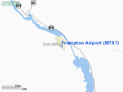
Location & QuickFacts
| FAA Information Effective: | 2008-09-25 |
| Airport Identifier: | MT97 |
| Airport Status: | Operational |
| Longitude/Latitude: | 115-46-04.6000W/47-58-42.8000N
-115.767944/47.978556 (Estimated) |
| Elevation: | 2400 ft / 731.52 m (Estimated) |
| Land: | 20 acres |
| From nearest city: | 1 nautical miles SE of Noxon, MT |
| Location: | Sanders County, MT |
| Magnetic Variation: | 18E (1990) |
Owner & Manager
| Ownership: | Privately owned |
| Owner: | Jesse & Hilda Frampton |
| Address: | Po Box 1526
Noxon, MT 59853 |
| Phone number: | 406-847-5503 |
| Manager: | Jesse & Hilda Frampton |
| Address: | Po Box 1526
Noxon, MT 59853 |
| Phone number: | 406-847-5503 |
Airport Operations and Facilities
| Airport Use: | Private |
| Segmented Circle: | No |
| Control Tower: | No |
| Sectional chart: | Great Falls |
| Region: | ANM - Northwest Mountain |
| Boundary ARTCC: | ZSE - Seattle |
| Tie-in FSS: | GTF - Great Falls |
| FSS Toll Free: | 1-800-WX-BRIEF |
Runway Information
Runway 09/27
| Dimension: | 1800 x 100 ft / 548.6 x 30.5 m |
| Surface: | TURF, |
| |
Runway 09 |
Runway 27 |
| Traffic Pattern: | Left | Left |
| Obstruction: | | 30 ft pline, 900.0 ft from runway |
|
Radio Navigation Aids
| ID |
Type |
Name |
Ch |
Freq |
Var |
Dist |
| LYI | NDB | Libby | | 414.00 | 17E | 22.4 nm |
| SZT | NDB | Sandpoe | | 264.00 | 20E | 37.0 nm |
| MLP | VOR/DME | Mullan Pass | 125X | 117.80 | 20E | 31.7 nm |
| COE | VOR/DME | Coeur D'alene | 025X | 108.80 | 19E | 44.2 nm |
Remarks
Images and information placed above are from
http://www.airport-data.com/airport/MT97/
We thank them for the data!
| General Info
|
| Country |
United States
|
| State |
MONTANA
|
| FAA ID |
MT97
|
| Latitude |
47-58-42.800N
|
| Longitude |
115-46-04.600W
|
| Elevation |
2400 feet
|
| Near City |
NOXON
|
We don't guarantee the information is fresh and accurate. The data may
be wrong or outdated.
For more up-to-date information please refer to other sources.
|
|


