 |
|
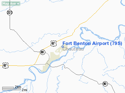
Location & QuickFacts
| FAA Information Effective: | 2008-09-25 |
| Airport Identifier: | 79S |
| Airport Status: | Operational |
| Longitude/Latitude: | 110-38-11.3300W/47-50-42.3900N
-110.636481/47.845108 (Estimated) |
| Elevation: | 2869 ft / 874.47 m (Estimated) |
| Land: | 365 acres |
| From nearest city: | 1 nautical miles NE of Fort Benton, MT |
| Location: | Chouteau County, MT |
| Magnetic Variation: | 14E (2005) |
Owner & Manager
| Ownership: | Publicly owned |
| Owner: | Ft Benton & Chouteau Co |
| Address: | County Courthouse, Po Box 459
Fort Benton, MT 59442 |
| Phone number: | 406-622-5151 |
| Manager: | George Carver
OR CONTACT ANDY TAYLOR 622-5682 |
| Address: | Box 494
Ft Benton, MT 59442 |
| Phone number: | 406-622-3489 |
Airport Operations and Facilities
| Airport Use: | Open to public |
| Wind indicator: | Yes |
| Segmented Circle: | Yes |
| Control Tower: | No |
| Lighting Schedule: | DUSK-DAWN
ACTVT MIRL RY 05/23 AND PAPI RYS 05 & 23 - CTAF |
| Beacon Color: | Clear-Green (lighted land airport) |
| Landing fee charge: | No |
| Sectional chart: | Great Falls |
| Region: | ANM - Northwest Mountain |
| Boundary ARTCC: | ZLC - Salt Lake City |
| Tie-in FSS: | GTF - Great Falls |
| FSS on Airport: | No |
| FSS Toll Free: | 1-800-WX-BRIEF |
| NOTAMs Facility: | GTF (NOTAM-d service avaliable) |
| Federal Agreements: | NGY |
Airport Communications
| CTAF: | 122.800 |
| Unicom: | 122.800 |
Airport Services
| Fuel available: | 100LL
CALL IN ADVANCE FOR FUEL 406-622-3221/5249/5011. |
| Airframe Repair: | MAJOR
FOR SVCS CALL 406-622-5011. |
| Power Plant Repair: | MAJOR |
| Bottled Oxygen: | NONE |
| Bulk Oxygen: | NONE |
Runway Information
Runway 05/23
| Dimension: | 4300 x 75 ft / 1310.6 x 22.9 m |
| Surface: | ASPH, Good Condition |
| Weight Limit: | Single wheel: 12500 lbs. |
| Edge Lights: | Medium |
| |
Runway 05 |
Runway 23 |
| Longitude: | 110-38-39.0770W | 110-37-43.5950W |
| Latitude: | 47-50-32.3270N | 47-50-52.4540N |
| Elevation: | 2868.00 ft | 2859.00 ft |
| Alignment: | 62 | 127 |
| Traffic Pattern: | Left | Left |
| Markings: | Basic, Good Condition | Basic, Good Condition |
| Crossing Height: | 40.00 ft | 40.00 ft |
| VASI: | 2-light PAPI on left side | 2-light PAPI on left side |
| Visual Glide Angle: | 3.00° | 3.00° |
| Obstruction: | 34 ft pline, 1727.0 ft from runway, 300 ft left of centerline, 44:1 slope to clear | , 50:1 slope to clear |
|
Runway 14/32
| Dimension: | 1700 x 75 ft / 518.2 x 22.9 m |
| Surface: | DIRT, Good Condition |
| |
Runway 14 |
Runway 32 |
| Longitude: | 110-38-22.0410W | 110-38-10.2170W |
| Latitude: | 47-50-38.0880N | 47-50-23.3200N |
| Elevation: | 2863.00 ft | 2866.00 ft |
| Alignment: | 127 | 127 |
| Traffic Pattern: | Left | Left |
| Obstruction: | 19 ft pline, 819.0 ft from runway, 43:1 slope to clear | , 50:1 slope to clear |
|
Radio Navigation Aids
| ID |
Type |
Name |
Ch |
Freq |
Var |
Dist |
| ITU | NDB | Truly | | 371.00 | 16E | 41.5 nm |
| LTY | NDB | Chester | | 323.00 | 15E | 42.2 nm |
| GFA | TACAN | Malmstrom | 105X | | 17E | 30.1 nm |
| GTF | VORTAC | Great Falls | 098X | 115.10 | 16E | 39.4 nm |
Remarks
- (PAY PHONE) PAY PHONE AVAILABLE.
Images and information placed above are from
http://www.airport-data.com/airport/79S/
We thank them for the data!
| General Info
|
| Country |
United States
|
| State |
MONTANA
|
| FAA ID |
79S
|
| Latitude |
47-50-45.000N
|
| Longitude |
110-38-01.000W
|
| Elevation |
2869 feet
|
| Near City |
FORT BENTON
|
We don't guarantee the information is fresh and accurate. The data may
be wrong or outdated.
For more up-to-date information please refer to other sources.
|
|


