 |
|
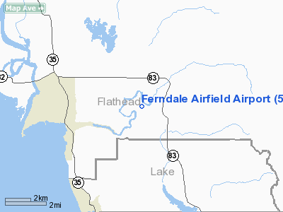
Ferndale Airfield Airport |
Location & QuickFacts
| FAA Information Effective: | 2008-09-25 |
| Airport Identifier: | 53U |
| Airport Status: | Operational |
| Longitude/Latitude: | 114-00-03.3920W/48-04-29.8340N
-114.000942/48.074954 (Estimated) |
| Elevation: | 3060 ft / 932.69 m (Estimated) |
| Land: | 35 acres |
| From nearest city: | 3 nautical miles NE of Big Fork, MT |
| Location: | Flathead County, MT |
| Magnetic Variation: | 18E (1985) |
Owner & Manager
| Ownership: | Publicly owned |
| Owner: | Flathead Muni Arpt Auth |
| Address: | 4170 Highway 2-e
Kalispell, MT 59901 |
| Phone number: | 406-257-5994 |
| Manager: | Mike Daigle |
| Address: | 4170 Highway 2-e
Kalispell, MT 59901 |
| Phone number: | 406-257-5994 |
Airport Operations and Facilities
| Airport Use: | Open to public |
| Wind indicator: | Yes |
| Segmented Circle: | No |
| Control Tower: | No |
| Landing fee charge: | No |
| Sectional chart: | Great Falls |
| Region: | ANM - Northwest Mountain |
| Boundary ARTCC: | ZLC - Salt Lake City |
| Tie-in FSS: | GTF - Great Falls |
| FSS on Airport: | No |
| FSS Toll Free: | 1-800-WX-BRIEF |
| NOTAMs Facility: | GTF (NOTAM-d service avaliable) |
Airport Communications
Airport Services
| Airframe Repair: | MAJOR |
| Power Plant Repair: | MAJOR |
| Bottled Oxygen: | NONE |
| Bulk Oxygen: | NONE |
Runway Information
Runway 15/33
| Dimension: | 3500 x 95 ft / 1066.8 x 29.0 m |
| Surface: | TURF, Good Condition |
| |
Runway 15 |
Runway 33 |
| Traffic Pattern: | Left | Left |
| Markings: | Basic,
15/33 WHITE CONES MARK FULL RY LENGTH. RED TRAFFIC CONES MARK EACH RY THRESHOLD. | , |
| Obstruction: | 86 ft trees, 1083.0 ft from runway, 203 ft right of centerline, 12:1 slope to clear | 88 ft trees, 258.0 ft from runway, 75 ft left of centerline, 3:1 slope to clear |
|
Radio Navigation Aids
| ID |
Type |
Name |
Ch |
Freq |
Var |
Dist |
| SAK | NDB | Smith Lake | | 515.00 | 18E | 18.6 nm |
| PLS | NDB | Polson | | 275.00 | 20E | 24.0 nm |
| FCA | VOR/DME | Kalispell | 079X | 113.20 | 18E | 10.9 nm |
Remarks
- SNOW REMOVAL MAY BE DELAYED CALL FOR CONDITIONS 406-257-5994.
- RY 15 +80 FT TREES 1647 FT FM EOR 0B; RY 33 +70 FT TREES 1743 FT FM EOR; RY 15 +15 FT ROAD 279 FT FM EOR 0B.
- TREES IN TRANSITION SFC BOTH SIDES OF RY FULL LENGTH.
- FREE BICYCLES FOR ARPT USE LCTD IN STORAGE SHED. TO ACCESS USE EMERG FREQ ON LOCK.
- RY 33 +50 FT TREE ON CNTRLN 350 FT FM EOR AT 7:1.
- PROVIDED COMPATIBLE INGRESS/EGRESS ARE ESTABLISHED IN ORDER TO AVOID CONGESTED AREAS AND ASSUME SAFETY TO PERSONS AND PROPERTY ON THE SURFACE.
Images and information placed above are from
http://www.airport-data.com/airport/53U/
We thank them for the data!
| General Info
|
| Country |
United States
|
| State |
MONTANA
|
| FAA ID |
53U
|
| Latitude |
48-04-29.834N
|
| Longitude |
114-00-03.392W
|
| Elevation |
3060 feet
|
| Near City |
BIG FORK
|
We don't guarantee the information is fresh and accurate. The data may
be wrong or outdated.
For more up-to-date information please refer to other sources.
|
|


