 |
|
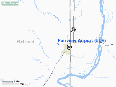
Location & QuickFacts
| FAA Information Effective: | 2008-09-25 |
| Airport Identifier: | 5U6 |
| Airport Status: | Operational |
| Longitude/Latitude: | 104-04-21.7610W/47-51-40.0660N
-104.072711/47.861129 (Estimated) |
| Elevation: | 2152 ft / 655.93 m (Surveyed) |
| Land: | 35 acres |
| From nearest city: | 1 nautical miles NW of Fairview, MT |
| Location: | Richland County, MT |
| Magnetic Variation: | 12E (1985) |
Owner & Manager
| Ownership: | Publicly owned |
| Owner: | Sidney Richland |
| Address: | Po Box 1050 Apt Authority
Sidney, MT 59270 |
| Phone number: | 406-433-2415 |
| Manager: | William Henderson |
| Address: | Po Box 1050
Sidney, MT 59270 |
| Phone number: | 406-433-2415 |
Airport Operations and Facilities
| Airport Use: | Open to public |
| Wind indicator: | Yes |
| Segmented Circle: | Yes |
| Control Tower: | No |
| Landing fee charge: | No |
| Sectional chart: | Billings |
| Region: | ANM - Northwest Mountain |
| Boundary ARTCC: | ZLC - Salt Lake City |
| Tie-in FSS: | GTF - Great Falls |
| FSS on Airport: | No |
| FSS Toll Free: | 1-800-WX-BRIEF |
| NOTAMs Facility: | GTF (NOTAM-d service avaliable) |
Airport Communications
Airport Services
| Airframe Repair: | NONE |
| Power Plant Repair: | NONE |
| Bottled Oxygen: | NONE |
| Bulk Oxygen: | NONE |
Runway Information
Runway 08/26
| Dimension: | 3000 x 95 ft / 914.4 x 29.0 m |
| Surface: | TURF, Good Condition |
| |
Runway 08 |
Runway 26 |
| Traffic Pattern: | Left | Left |
| Obstruction: | 12 ft road, 369.0 ft from runway, 30:1 slope to clear | 17 ft pole, 494.0 ft from runway, 114 ft right of centerline, 29:1 slope to clear |
|
Radio Navigation Aids
| ID |
Type |
Name |
Ch |
Freq |
Var |
Dist |
| SDY | NDB | Sidney | | 359.00 | 12E | 10.0 nm |
| ISN | NDB | Williston | | 275.00 | 15E | 26.1 nm |
| ISN | VORTAC | Williston | 110X | 116.30 | 12E | 26.9 nm |
Remarks
- FOR AIRPORT CONDITIONS OR SNOW REMOVAL CONTACT AMGR 406-433-2415.
Images and information placed above are from
http://www.airport-data.com/airport/5U6/
We thank them for the data!
| General Info
|
| Country |
United States
|
| State |
MONTANA
|
| FAA ID |
5U6
|
| Latitude |
47-51-40.066N
|
| Longitude |
104-04-21.761W
|
| Elevation |
2152 feet
|
| Near City |
FAIRVIEW
|
We don't guarantee the information is fresh and accurate. The data may
be wrong or outdated.
For more up-to-date information please refer to other sources.
|
|


