 |
|
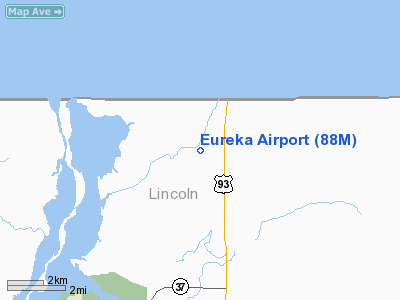
Location & QuickFacts
| FAA Information Effective: | 2008-09-25 |
| Airport Identifier: | 88M |
| Airport Status: | Operational |
| Longitude/Latitude: | 115-04-34.9700W/48-58-25.7200N
-115.076381/48.973811 (Estimated) |
| Elevation: | 2668 ft / 813.21 m (Surveyed) |
| Land: | 0 acres |
| From nearest city: | 5 nautical miles N of Eureka, MT |
| Location: | Lincoln County, MT |
| Magnetic Variation: | 19E (1990) |
Owner & Manager
| Ownership: | Publicly owned |
| Owner: | County Of Lincoln |
| Address: | 512 Calfornia Ave
Libby, MT 59923 |
| Phone number: | 406-293-7781 |
| Manager: | Craig Eaton |
| Address: | Box 564
Eureka, MT 59917 |
| Phone number: | 406-297-2943 |
Airport Operations and Facilities
| Airport Use: | Open to public |
| Wind indicator: | Yes |
| Segmented Circle: | Yes |
| Control Tower: | No |
| Lighting Schedule: | DUSK-DAWN
ACTVT MIRL RY 18/36 AND PAPI RYS 18 & 36- CTAF. |
| Beacon Color: | Clear-Green (lighted land airport) |
| Sectional chart: | Great Falls |
| Region: | ANM - Northwest Mountain |
| Boundary ARTCC: | ZSE - Seattle |
| Tie-in FSS: | GTF - Great Falls |
| FSS Toll Free: | 1-800-WX-BRIEF |
| NOTAMs Facility: | GTF (NOTAM-d service avaliable) |
| Federal Agreements: | N |
Airport Communications
Airport Services
| Fuel available: | 100LL
24 HR SELF SERVICE CREDIT CARD FUEL . |
Runway Information
Runway 18/36
| Dimension: | 4200 x 75 ft / 1280.2 x 22.9 m |
| Surface: | ASPH, Good Condition |
| Weight Limit: | Single wheel: 12500 lbs. |
| |
Runway 18 |
Runway 36 |
| Traffic Pattern: | Left | Left |
| Markings: | Basic, Good Condition | Basic, Good Condition |
| Crossing Height: | 40.00 ft | 40.00 ft |
| VASI: | 2-light PAPI on left side | 2-light PAPI on left side |
| Visual Glide Angle: | 3.00° | 3.00° |
| Obstruction: | 30 ft trees, 1155.0 ft from runway, 225 ft right of centerline, 31:1 slope to clear | 48 ft tree, 1791.0 ft from runway, 148 ft left of centerline, 33:1 slope to clear |
|
Radio Navigation Aids
| ID |
Type |
Name |
Ch |
Freq |
Var |
Dist |
| EUR | NDB | Eureka | | 392.00 | 20E | 0.9 nm |
| LYI | NDB | Libby | | 414.00 | 17E | 43.5 nm |
Remarks
- HILL 2200 FT FROM RY RY 18 THR, 2300 FT LEFT 162 FT ABOVE RY 18 THR.
- WX STATION ON ARPT; ACTVT CTAF 2 CLICKS.
Images and information placed above are from
http://www.airport-data.com/airport/88M/
We thank them for the data!
| General Info
|
| Country |
United States
|
| State |
MONTANA
|
| FAA ID |
88M
|
| Latitude |
48-58-07.876N
|
| Longitude |
115-04-13.607W
|
| Elevation |
2668 feet
|
| Near City |
EUREKA
|
We don't guarantee the information is fresh and accurate. The data may
be wrong or outdated.
For more up-to-date information please refer to other sources.
|
|


