 |
|
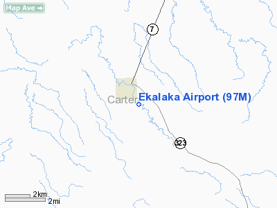
Location & QuickFacts
| FAA Information Effective: | 2008-09-25 |
| Airport Identifier: | 97M |
| Airport Status: | Operational |
| Longitude/Latitude: | 104-32-15.0260W/45-52-40.4920N
-104.537507/45.877914 (Estimated) |
| Elevation: | 3503 ft / 1067.71 m (Surveyed) |
| Land: | 162 acres |
| From nearest city: | 2 nautical miles SE of Ekalaka, MT |
| Location: | Carter County, MT |
| Magnetic Variation: | 12E (1990) |
Owner & Manager
| Ownership: | Publicly owned |
| Owner: | County Of Carter |
| Address: | County Court House
Ekalaka, MT 59324 |
| Phone number: | 406-775-8749 |
| Manager: | Troy Fruit |
| Address: | County Court House
Ekalaka, MT 59324 |
| Phone number: | 406-775-6541 |
Airport Operations and Facilities
| Airport Use: | Open to public |
| Wind indicator: | Yes |
| Segmented Circle: | Yes |
| Control Tower: | No |
| Lighting Schedule: | DUSK-DAWN
MIRL RY 13/31 & PAPI RYS 13 & 31 PRESET MEDIUM INTST DUSK-0000; OTHER HRS ACTVT - CTAF. |
| Beacon Color: | Clear-Green (lighted land airport)
BEACON IS LOCATED 3/4 MILE NE ON HILL TOP. |
| Sectional chart: | Billings |
| Region: | ANM - Northwest Mountain |
| Boundary ARTCC: | ZLC - Salt Lake City |
| Tie-in FSS: | GTF - Great Falls |
| FSS Toll Free: | 1-800-WX-BRIEF |
| NOTAMs Facility: | GTF (NOTAM-d service avaliable) |
| Federal Agreements: | N |
Airport Communications
Airport Services
Runway Information
Runway 13/31
| Dimension: | 3800 x 75 ft / 1158.2 x 22.9 m |
| Surface: | ASPH, Good Condition |
| Weight Limit: | Single wheel: 12500 lbs. |
| Edge Lights: | Medium |
| |
Runway 13 |
Runway 31 |
| Traffic Pattern: | Left | Left |
| Markings: | Non-precision instrument, Good Condition | Non-precision instrument, Good Condition |
| Crossing Height: | 24.00 ft | 29.00 ft |
| VASI: | 2-light PAPI on left side
RY 31 PAPI OTS INDEFLY. | 2-light PAPI on left side |
| Visual Glide Angle: | 3.00° | 3.00° |
| Obstruction: | , 50:1 slope to clear | 20 ft , 887.0 ft from runway, 30 ft right of centerline, 34:1 slope to clear
80' TALL HILLS IN TRANSITIONAL SURFACE, SOUTH SIDE OF APT, 700' FROM RWY EDGE |
|
Radio Navigation Aids
| ID |
Type |
Name |
Ch |
Freq |
Var |
Dist |
| BKU | NDB | Timber | | 344.00 | 12E | 30.6 nm |
| BDX | NDB | Broadus | | 335.00 | 15E | 45.3 nm |
| BOD | NDB | Bowman | | 374.00 | 10E | 49.8 nm |
| BUA | VOR/DME | Buffalo | 031X | 109.40 | 13E | 49.4 nm |
Remarks
Images and information placed above are from
http://www.airport-data.com/airport/97M/
We thank them for the data!
| General Info
|
| Country |
United States
|
| State |
MONTANA
|
| FAA ID |
97M
|
| Latitude |
45-52-40.492N
|
| Longitude |
104-32-15.026W
|
| Elevation |
3503 feet
|
| Near City |
EKALAKA
|
We don't guarantee the information is fresh and accurate. The data may
be wrong or outdated.
For more up-to-date information please refer to other sources.
|
|


