 |
|
Location & QuickFacts
| FAA Information Effective: | 2008-09-25 |
| Airport Identifier: | 5U1 |
| Airport Status: | Operational |
| Longitude/Latitude: | 111-41-53.9640W/47-50-49.8530N
-111.698323/47.847181 (Estimated) |
| Elevation: | 3699 ft / 1127.46 m (Surveyed) |
| Land: | 30 acres |
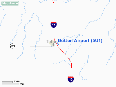
| From nearest city: | 1 nautical miles E of Dutton, MT |
| Location: | Teton County, MT |
| Magnetic Variation: | 17E (1985) |
Owner & Manager
| Ownership: | Publicly owned |
| Owner: | Dutton And Teton County |
| Address: | City Hall
Choteau, MT 59422 |
| Phone number: | 406-476-3311 |
| Manager: | Mike Campbell |
| Address: | Po Box 166
Dutton, MT 59433 |
| Phone number: | 406-476-3332
OR 406-463-2268. |
Airport Operations and Facilities
| Airport Use: | Open to public |
| Wind indicator: | Yes |
| Segmented Circle: | Yes |
| Control Tower: | No |
| Lighting Schedule: | DUSK-DAWN |
| Beacon Color: | Clear-Green (lighted land airport) |
| Landing fee charge: | No |
| Sectional chart: | Great Falls |
| Region: | ANM - Northwest Mountain |
| Boundary ARTCC: | ZLC - Salt Lake City |
| Tie-in FSS: | GTF - Great Falls |
| FSS on Airport: | No |
| FSS Toll Free: | 1-800-WX-BRIEF |
| NOTAMs Facility: | GTF (NOTAM-d service avaliable) |
Airport Communications
Airport Services
| Airframe Repair: | NONE |
| Power Plant Repair: | NONE |
| Bottled Oxygen: | NONE |
| Bulk Oxygen: | NONE |
Runway Information
Runway 16/34
| Dimension: | 3130 x 115 ft / 954.0 x 35.1 m |
| Surface: | ASPH-TURF, Good Condition
2430 FT BY 40 FT ASPH STRIP S END CNTR PORTION FOLLOWED BY 700 FT BY 115 FT TURF. |
| Edge Lights: | Non-standard lighting system
NSTD LIRL. RY EDGE LGTS DSPLCD FM RY 34 70' R 55' L FM RY CNTRLN. HAS 363 FT OF UNLIGHTED THLD; 2767 FT OF RY LIGHTED FOR NIGHT OPER. |
| |
Runway 16 |
Runway 34 |
| Traffic Pattern: | Left | Left |
| Obstruction: | , 50:1 slope to clear | 170 ft hill, 4450.0 ft from runway, 25:1 slope to clear
RY 34 HAS +20 FT ROAD 84 FT FROM ASPH. RY END CROSSING EXTNDD RY CNTRLN 0B. |
|
Radio Navigation Aids
| ID |
Type |
Name |
Ch |
Freq |
Var |
Dist |
| CII | NDB | Choteau | | 269.00 | 17E | 19.1 nm |
| CRD | NDB | Conrad | | 293.00 | 17E | 22.1 nm |
| ITU | NDB | Truly | | 371.00 | 16E | 31.8 nm |
| SBX | NDB | Shelby | | 347.00 | 18E | 42.2 nm |
| LTY | NDB | Chester | | 323.00 | 15E | 49.0 nm |
| GFA | TACAN | Malmstrom | 105X | | 17E | 29.4 nm |
| GTF | VORTAC | Great Falls | 098X | 115.10 | 16E | 26.5 nm |
Remarks
- SNOW REMOVAL INTERMITTENT
- RWY 16 -6' DEPRESSION STARTS 102' FROM RWY END.
- ESTBL PRIOR TO 1959.
Images and information placed above are from
http://www.airport-data.com/airport/5U1/
We thank them for the data!
| General Info
|
| Country |
United States
|
| State |
MONTANA
|
| FAA ID |
5U1
|
| Latitude |
47-50-49.853N
|
| Longitude |
111-41-53.964W
|
| Elevation |
3699 feet
|
| Near City |
DUTTON
|
We don't guarantee the information is fresh and accurate. The data may
be wrong or outdated.
For more up-to-date information please refer to other sources.
|
|


