 |
|
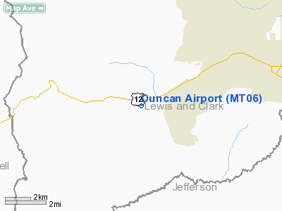
Location & QuickFacts
| FAA Information Effective: | 2008-09-25 |
| Airport Identifier: | MT06 |
| Airport Status: | Operational |
| Longitude/Latitude: | 112-10-30.0240W/46-34-12.7610N
-112.175007/46.570211 (Estimated) |
| Elevation: | 4260 ft / 1298.45 m (Estimated) |
| Land: | 40 acres |
| From nearest city: | 6 nautical miles W of Helena, MT |
| Location: | Lewis And Clark County, MT |
| Magnetic Variation: | 17E (1985) |
Owner & Manager
| Ownership: | Privately owned |
| Owner: | Cary Duncan |
| Address: | 6062 Willow Cr. Rd.
Helena, MT 59601 |
| Phone number: | 406-443-3640 |
| Address: |
|
Airport Operations and Facilities
| Airport Use: | Private |
| Wind indicator: | Yes |
| Segmented Circle: | No |
| Control Tower: | No |
| Sectional chart: | Great Falls |
| Region: | ANM - Northwest Mountain |
| Boundary ARTCC: | ZLC - Salt Lake City |
| Tie-in FSS: | GTF - Great Falls |
| FSS Toll Free: | 1-800-WX-BRIEF |
Runway Information
Runway 07/25
| Dimension: | 1467 x 50 ft / 447.1 x 15.2 m |
| Surface: | TURF, |
| |
Runway 07 |
Runway 25 |
| Traffic Pattern: | Left | Left |
|
Radio Navigation Aids
| ID |
Type |
Name |
Ch |
Freq |
Var |
Dist |
| CVP | NDB | Capitol | | 335.00 | 16E | 10.1 nm |
| HAU | NDB | Hauser | | 386.00 | 16E | 17.2 nm |
| DRU | VOR | Drummond | | 117.10 | 17E | 42.0 nm |
| CPN | VOR/DME | Coppertown | 053X | 111.60 | 16E | 40.1 nm |
| HLN | VORTAC | Helena | 124X | 117.70 | 16E | 9.4 nm |
| HIA | VORTAC | Whitehall | 084X | 113.70 | 18E | 42.6 nm |
Images and information placed above are from
http://www.airport-data.com/airport/MT06/
We thank them for the data!
| General Info
|
| Country |
United States
|
| State |
MONTANA
|
| FAA ID |
MT06
|
| Latitude |
46-34-12.761N
|
| Longitude |
112-10-30.024W
|
| Elevation |
4260 feet
|
| Near City |
HELENA
|
We don't guarantee the information is fresh and accurate. The data may
be wrong or outdated.
For more up-to-date information please refer to other sources.
|
|


