 |
|
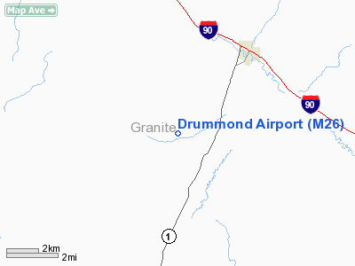
Location & QuickFacts
| FAA Information Effective: | 2008-09-25 |
| Airport Identifier: | M26 |
| Airport Status: | Operational |
| Longitude/Latitude: | 113-12-18.2380W/46-37-14.7450N
-113.205066/46.620762 (Estimated) |
| Elevation: | 4245 ft / 1293.88 m (Surveyed) |
| Land: | 34 acres |
| From nearest city: | 3 nautical miles SW of Drummond, MT |
| Location: | Granite County, MT |
| Magnetic Variation: | 17E (1985) |
Owner & Manager
| Ownership: | Publicly owned |
| Owner: | Granite County |
| Address: | County Courthouse
Philipsburg, MT 59858 |
| Phone number: | 406-859-3521 |
| Manager: | Ty Throope |
| Address: | 4949 Hwy 1
Drummond, MT 59832 |
| Phone number: | 406-288-3819
406-544-3733 (CELL) |
Airport Operations and Facilities
| Airport Use: | Open to public |
| Wind indicator: | Yes |
| Segmented Circle: | Yes |
| Control Tower: | No |
| Landing fee charge: | No |
| Sectional chart: | Great Falls |
| Region: | ANM - Northwest Mountain |
| Boundary ARTCC: | ZLC - Salt Lake City |
| Tie-in FSS: | GTF - Great Falls |
| FSS on Airport: | No |
| FSS Toll Free: | 1-800-WX-BRIEF |
| NOTAMs Facility: | 3DU (NOTAM-d service avaliable) |
Airport Communications
Airport Services
| Airframe Repair: | NONE |
| Power Plant Repair: | NONE |
| Bottled Oxygen: | NONE |
| Bulk Oxygen: | NONE |
Runway Information
Runway 07/25
| Dimension: | 2400 x 125 ft / 731.5 x 38.1 m |
| Surface: | TURF, Fair Condition |
| |
Runway 07 |
Runway 25 |
| Traffic Pattern: | Left | Left |
| Obstruction: | 15 ft road, 105.0 ft from runway, 7:1 slope to clear | 4 ft fence, 80.0 ft from runway, 20:1 slope to clear |
|
Radio Navigation Aids
| ID |
Type |
Name |
Ch |
Freq |
Var |
Dist |
| HMM | NDB | Hamilton | | 410.00 | 19E | 44.3 nm |
| DRU | VOR | Drummond | | 117.10 | 17E | 1.2 nm |
| MSO | VOR/DME | Missoula | 075X | 112.80 | 17E | 40.1 nm |
| CPN | VOR/DME | Coppertown | 053X | 111.60 | 16E | 40.2 nm |
Remarks
- SNOW REMOVAL IREG.
- RY 09/27 EXTREMELY SOFT WHEN WET.
- ESTABD PRIOR 1959.
Images and information placed above are from
http://www.airport-data.com/airport/M26/
We thank them for the data!
| General Info
|
| Country |
United States
|
| State |
MONTANA
|
| FAA ID |
M26
|
| Latitude |
46-37-14.745N
|
| Longitude |
113-12-18.238W
|
| Elevation |
4245 feet
|
| Near City |
DRUMMOND
|
We don't guarantee the information is fresh and accurate. The data may
be wrong or outdated.
For more up-to-date information please refer to other sources.
|
|


