 |
|
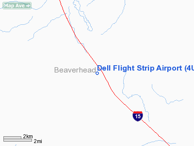
Dell Flight Strip Airport |
Location & QuickFacts
| FAA Information Effective: | 2008-09-25 |
| Airport Identifier: | 4U9 |
| Airport Status: | Operational |
| Longitude/Latitude: | 112-43-12.0480W/44-44-08.6940N
-112.720013/44.735748 (Estimated) |
| Elevation: | 6007 ft / 1830.93 m (Surveyed) |
| Land: | 147 acres |
| From nearest city: | 1 nautical miles NW of Dell, MT |
| Location: | Beaverhead County, MT |
| Magnetic Variation: | 16E (1985) |
Owner & Manager
| Ownership: | Publicly owned |
| Owner: | Mt Aero Division |
| Address: | Po Box 200507
Helena, MT 59620-0507 |
| Phone number: | 406-444-2506 |
| Manager: | Mt Aeronautics Division |
| Address: | Box 200507
Helena, MT 59620-0507 |
| Phone number: | 406-444-2506 |
Airport Operations and Facilities
| Airport Use: | Open to public |
| Wind indicator: | Yes |
| Segmented Circle: | No |
| Control Tower: | No |
| Lighting Schedule: | DUSK-DAWN
ACTVT MIRL RY 14/32 & PAPI RY 14 - CTAF. |
| Beacon Color: | Clear-Green (lighted land airport) |
| Landing fee charge: | No |
| Sectional chart: | Great Falls |
| Region: | ANM - Northwest Mountain |
| Boundary ARTCC: | ZLC - Salt Lake City |
| Tie-in FSS: | GTF - Great Falls |
| FSS on Airport: | No |
| FSS Toll Free: | 1-800-WX-BRIEF |
| NOTAMs Facility: | GTF (NOTAM-d service avaliable) |
Airport Communications
Airport Services
| Airframe Repair: | NONE |
| Power Plant Repair: | NONE |
| Bottled Oxygen: | NONE |
| Bulk Oxygen: | NONE |
Runway Information
Runway 14/32
| Dimension: | 7000 x 70 ft / 2133.6 x 21.3 m |
| Surface: | ASPH, Good Condition |
| Edge Lights: | Medium |
| |
Runway 14 |
Runway 32 |
| Traffic Pattern: | Left | Left |
| Markings: | Basic, Good Condition | Basic, Good Condition |
| Crossing Height: | 30.00 ft | 0.00 ft |
| VASI: | 2-light PAPI on left side | |
| Visual Glide Angle: | 3.50° | 0.00° |
| Obstruction: | 25 ft pline, 1077.0 ft from runway, 35:1 slope to clear | 17 ft road, 483.0 ft from runway, 16:1 slope to clear |
|
Radio Navigation Aids
| ID |
Type |
Name |
Ch |
Freq |
Var |
Dist |
| DLN | VOR/DME | Dillon | 077X | 113.00 | 18E | 31.7 nm |
| DBS | VORTAC | Dubois | 116X | 116.90 | 15E | 44.6 nm |
Remarks
- SNOW REMOVAL IRREGULAR.
- DEER ON & INVOF ARPT.
Images and information placed above are from
http://www.airport-data.com/airport/4U9/
We thank them for the data!
| General Info
|
| Country |
United States
|
| State |
MONTANA
|
| FAA ID |
4U9
|
| Latitude |
44-44-08.694N
|
| Longitude |
112-43-12.048W
|
| Elevation |
6007 feet
|
| Near City |
DELL
|
We don't guarantee the information is fresh and accurate. The data may
be wrong or outdated.
For more up-to-date information please refer to other sources.
|
|


