 |
|
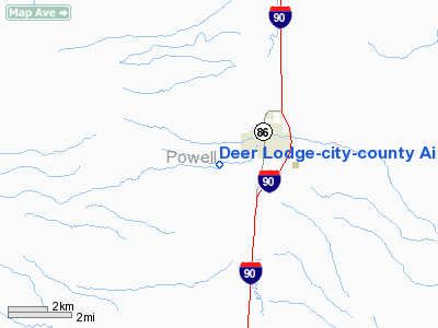
Deer Lodge-city-county Airport |
Location & QuickFacts
| FAA Information Effective: | 2008-09-25 |
| Airport Identifier: | 38S |
| Airport Status: | Operational |
| Longitude/Latitude: | 112-45-52.4700W/46-23-12.2600N
-112.764575/46.386739 (Estimated) |
| Elevation: | 4693 ft / 1430.43 m (Estimated) |
| Land: | 460 acres |
| From nearest city: | 2 nautical miles W of Deer Lodge, MT |
| Location: | Powell County, MT |
| Magnetic Variation: | 17E (1985) |
Owner & Manager
| Ownership: | Publicly owned |
| Owner: | Powell County |
| Address: | 409 Missouri Ave
Deer Lodge, MT 59722-1084 |
| Phone number: | 406-846-3680 |
| Manager: | Ron Kelley |
| Address: | 2944 Greenhouse Road
Deer Lodge, MT 59722 |
| Phone number: | 406-846-2300
ALSO 406-846-3825. |
Airport Operations and Facilities
| Airport Use: | Open to public |
| Wind indicator: | Yes |
| Segmented Circle: | Yes |
| Control Tower: | No |
| Lighting Schedule: | DUSK-DAWN
ACTVT MIRL RY 12/30 & PAPI RYS 12 & 30 - CTAF. |
| Beacon Color: | Clear-Green (lighted land airport) |
| Landing fee charge: | No |
| Sectional chart: | Great Falls |
| Region: | ANM - Northwest Mountain |
| Boundary ARTCC: | ZLC - Salt Lake City |
| Tie-in FSS: | GTF - Great Falls |
| FSS on Airport: | No |
| FSS Toll Free: | 1-800-WX-BRIEF |
| NOTAMs Facility: | GTF (NOTAM-d service avaliable) |
| Federal Agreements: | NGY |
Airport Communications
Airport Services
| Fuel available: | 100LLA |
| Airframe Repair: | NONE |
| Power Plant Repair: | NONE |
| Bottled Oxygen: | NONE |
| Bulk Oxygen: | NONE |
Runway Information
Runway 12/30
| Dimension: | 5799 x 75 ft / 1767.5 x 22.9 m
RY 12/30 EXTDD SE END. |
| Surface: | ASPH, Good Condition |
| Weight Limit: | Single wheel: 30000 lbs.
Dual wheel: 36000 lbs. |
| Edge Lights: | Medium |
| |
Runway 12 |
Runway 30 |
| Longitude: | 112-46-18.6000W | 112-45-26.3500W |
| Latitude: | 46-23-34.4500N | 46-22-50.0700N |
| Elevation: | 4692.00 ft | 4628.00 ft |
| Alignment: | 127 | 127 |
| Traffic Pattern: | Left | Left |
| Markings: | Non-precision instrument, Good Condition | Non-precision instrument, Good Condition |
| Crossing Height: | 35.00 ft | 24.00 ft |
| VASI: | 2-light PAPI on left side | 2-light PAPI on left side |
| Visual Glide Angle: | 3.75° | 3.00° |
| Obstruction: | 345 ft hill, 7800.0 ft from runway, 23:1 slope to clear | , 50:1 slope to clear
+28' TREES 250' LEFT OF RWY CNTRLN EXTENDED. |
|
Radio Navigation Aids
| ID |
Type |
Name |
Ch |
Freq |
Var |
Dist |
| CVP | NDB | Capitol | | 335.00 | 16E | 36.7 nm |
| HAU | NDB | Hauser | | 386.00 | 16E | 43.1 nm |
| DRU | VOR | Drummond | | 117.10 | 17E | 23.0 nm |
| CPN | VOR/DME | Coppertown | 053X | 111.60 | 16E | 21.3 nm |
| HLN | VORTAC | Helena | 124X | 117.70 | 16E | 36.1 nm |
| HIA | VORTAC | Whitehall | 084X | 113.70 | 18E | 40.1 nm |
Remarks
Images and information placed above are from
http://www.airport-data.com/airport/38S/
We thank them for the data!
| General Info
|
| Country |
United States
|
| State |
MONTANA
|
| FAA ID |
38S
|
| Latitude |
46-23-19.737N
|
| Longitude |
112-46-01.143W
|
| Elevation |
4689 feet
|
| Near City |
DEER LODGE
|
We don't guarantee the information is fresh and accurate. The data may
be wrong or outdated.
For more up-to-date information please refer to other sources.
|
|


