 |
|
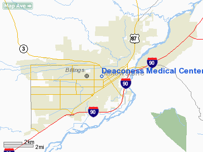
Deaconess Medical Center Of Billings Inc Heliport |
Location & QuickFacts
| FAA Information Effective: | 2008-09-25 |
| Airport Identifier: | MT55 |
| Airport Status: | Operational |
| Longitude/Latitude: | 108-31-02.4890W/45-47-14.8270N
-108.517358/45.787452 (Estimated) |
| Elevation: | 3137 ft / 956.16 m (Estimated) |
| Land: | 0 acres |
| From nearest city: | 0 nautical miles N of Billings, MT |
| Location: | Yellowstone County, MT |
| Magnetic Variation: | 15E (1985) |
Owner & Manager
| Ownership: | Privately owned |
| Owner: | Deaconess Med Ctr Of Billings |
| Address: | Po Box 37000
Billings, MT 59101 |
| Manager: | Lane Basso, President |
| Address: | Po Box 37000
Billings, MT 59102 |
| Phone number: | 406-657-4000 |
Airport Operations and Facilities
| Airport Use: | Private
MEDICAL USE. |
| Wind indicator: | Yes |
| Segmented Circle: | No |
| Control Tower: | No |
| Landing fee charge: | No |
| Sectional chart: | Billings |
| Region: | ANM - Northwest Mountain |
| Boundary ARTCC: | ZLC - Salt Lake City |
| Tie-in FSS: | GTF - Great Falls |
| FSS on Airport: | No |
| FSS Toll Free: | 1-800-WX-BRIEF |
Runway Information
Helipad H1
| Dimension: | 20 x 20 ft / 6.1 x 6.1 m |
| Surface: | CONC, |
| |
Runway H1 |
Runway |
| Traffic Pattern: | Left | Left |
|
Radio Navigation Aids
| ID |
Type |
Name |
Ch |
Freq |
Var |
Dist |
| RPX | NDB | Roundup | | 362.00 | 17E | 41.7 nm |
| RED | NDB | Red Lodge | | 203.00 | 17E | 45.5 nm |
| BIL | VORTAC | Billings | 092X | 114.50 | 14E | 4.7 nm |
Images and information placed above are from
http://www.airport-data.com/airport/MT55/
We thank them for the data!
| General Info
|
| Country |
United States
|
| State |
MONTANA
|
| FAA ID |
MT55
|
| Latitude |
45-47-14.827N
|
| Longitude |
108-31-02.489W
|
| Elevation |
3137 feet
|
| Near City |
BILLINGS
|
We don't guarantee the information is fresh and accurate. The data may
be wrong or outdated.
For more up-to-date information please refer to other sources.
|
|


