|
|
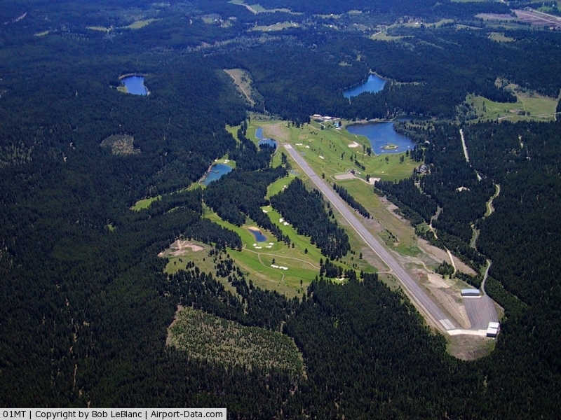
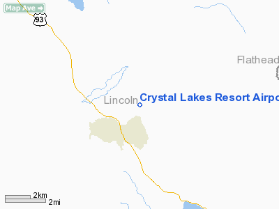
Crystal Lakes Resort Airport |
|
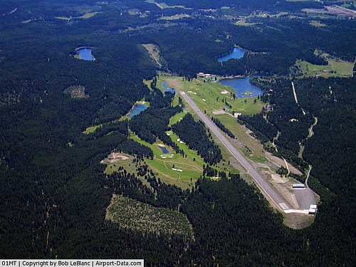 |
(Click on the photo to enlarge) |
Location & QuickFacts
| FAA Information Effective: | 2008-09-25 |
| Airport Identifier: | 01MT |
| Airport Status: | Operational |
| Longitude/Latitude: | 114-52-49.5710W/48-47-20.8750N
-114.880436/48.789132 (Estimated) |
| Elevation: | 3141 ft / 957.38 m (Estimated) |
| Land: | 0 acres |
| From nearest city: | 2 nautical miles NE of Fortine, MT |
| Location: | Lincoln County, MT |
| Magnetic Variation: | 19E (1985) |
Owner & Manager
| Ownership: | Privately owned |
| Owner: | James E. Smith |
| Address: | Crystal Lake
Fortine, MT 59918 |
| Phone number: | 406-752-7662 |
| Manager: | Jeri Talcott |
| Address: | Box 255
Fortine, MT 59918 |
| Phone number: | 406-752-7662 |
Airport Operations and Facilities
| Airport Use: | Private |
| Wind indicator: | Yes |
| Segmented Circle: | No |
| Control Tower: | No |
| Landing fee charge: | No |
| Sectional chart: | Great Falls |
| Region: | ANM - Northwest Mountain |
| Boundary ARTCC: | ZSE - Seattle |
| Tie-in FSS: | GTF - Great Falls |
| FSS on Airport: | No |
| FSS Toll Free: | 1-800-WX-BRIEF |
Airport Communications
Airport Services
| Airframe Repair: | NONE |
| Power Plant Repair: | NONE |
| Bottled Oxygen: | NONE |
| Bulk Oxygen: | NONE |
Runway Information
Runway 13/31
| Dimension: | 5000 x 70 ft / 1524.0 x 21.3 m |
| Surface: | ASPH, Good Condition |
| Weight Limit: | Single wheel: 4000 lbs. |
| |
Runway 13 |
Runway 31 |
| Traffic Pattern: | Left | Left |
| Markings: | Basic, Good Condition | Basic, Good Condition |
| Displaced threshold: | 0.00 ft | 150.00 ft |
| Runway End Identifier: | No | No |
| Centerline Lights: | No | No |
| Touchdown Lights: | No | No |
| Obstruction: | 22 ft trees, 470.0 ft from runway, 12:1 slope to clear | 40 ft trees, 1000.0 ft from runway, 20:1 slope to clear
APCH RATIO 12:1 TO DSPLCD THR.
+15' ROAD 30' FROM THR. |
|
Radio Navigation Aids
| ID |
Type |
Name |
Ch |
Freq |
Var |
Dist |
| EUR | NDB | Eureka | | 392.00 | 20E | 13.4 nm |
| LYI | NDB | Libby | | 414.00 | 17E | 38.0 nm |
| SAK | NDB | Smith Lake | | 515.00 | 18E | 44.2 nm |
| FCA | VOR/DME | Kalispell | 079X | 113.20 | 18E | 44.5 nm |
Remarks
- SNOW REMOVAL BY PRIOR REQ.
- DSPLCD THR NOT MKD OR LGTD.
Images and information placed above are from
http://www.airport-data.com/airport/01MT/
We thank them for the data!
| General Info
|
| Country |
United States
|
| State |
MONTANA
|
| FAA ID |
01MT
|
| Latitude |
48-47-20.875N
|
| Longitude |
114-52-49.571W
|
| Elevation |
3141 feet
|
| Near City |
FORTINE
|
We don't guarantee the information is fresh and accurate. The data may
be wrong or outdated.
For more up-to-date information please refer to other sources.
|
|