 |
|
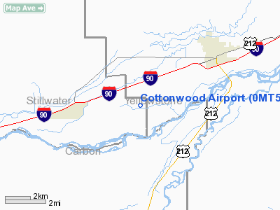
Location & QuickFacts
| FAA Information Effective: | 2008-09-25 |
| Airport Identifier: | 0MT5 |
| Airport Status: | Operational |
| Longitude/Latitude: | 108-50-56.0000W/45-38-03.0000N
-108.848889/45.634167 (Estimated) |
| Elevation: | 3350 ft / 1021.08 m (Estimated) |
| Land: | 10 acres |
| From nearest city: | 6 nautical miles SW of Laurel, MT |
| Location: | Stillwater County, MT |
| Magnetic Variation: | 14E (1995) |
Owner & Manager
| Ownership: | Privately owned |
| Owner: | Dwight & George Felmlee |
| Address: | Po Box 146
Laurel, MT 59044 |
| Phone number: | 406-633-2261 |
| Manager: | George S Felmlee |
| Address: | Po Box 146
Laurel, MT 59044 |
| Phone number: | 406-633-2261 |
Airport Operations and Facilities
| Airport Use: | Private |
| Segmented Circle: | No |
| Control Tower: | No |
| Sectional chart: | Cheyenne |
| Region: | ANM - Northwest Mountain |
| Boundary ARTCC: | ZLC - Salt Lake City |
| Tie-in FSS: | GTF - Great Falls |
| FSS on Airport: | No |
| FSS Toll Free: | 1-800-WX-BRIEF |
Runway Information
Runway 17/35
| Dimension: | 750 x 40 ft / 228.6 x 12.2 m |
| Surface: | TURF, |
| |
Runway 17 |
Runway 35 |
| Traffic Pattern: | Left | Left |
|
Radio Navigation Aids
| ID |
Type |
Name |
Ch |
Freq |
Var |
Dist |
| RED | NDB | Red Lodge | | 203.00 | 17E | 29.5 nm |
| POY | NDB | Powell | | 344.00 | 15E | 46.2 nm |
| HCY | NDB | Cowley | | 257.00 | 14E | 46.6 nm |
| BIL | VORTAC | Billings | 092X | 114.50 | 14E | 14.1 nm |
Remarks
Images and information placed above are from
http://www.airport-data.com/airport/0MT5/
We thank them for the data!
| General Info
|
| Country |
United States
|
| State |
MONTANA
|
| FAA ID |
0MT5
|
| Latitude |
45-38-03.000N
|
| Longitude |
108-50-56.000W
|
| Elevation |
3350 feet
|
| Near City |
LAUREL
|
We don't guarantee the information is fresh and accurate. The data may
be wrong or outdated.
For more up-to-date information please refer to other sources.
|
|


