 |
|
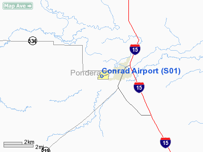
Location & QuickFacts
| FAA Information Effective: | 2008-09-25 |
| Airport Identifier: | S01 |
| Airport Status: | Operational |
| Longitude/Latitude: | 111-58-35.3000W/48-10-07.1000N
-111.976472/48.168639 (Estimated) |
| Elevation: | 3545 ft / 1080.52 m (Surveyed) |
| Land: | 310 acres |
| From nearest city: | 1 nautical miles W of Conrad, MT |
| Location: | Pondera County, MT |
| Magnetic Variation: | 17E (1985) |
Owner & Manager
| Ownership: | Publicly owned |
| Owner: | Pondera County |
| Address: | Pondera County Courthouse
Conrad, MT 59425 |
| Phone number: | 406-271-4010 |
| Manager: | Steve Becker |
| Address: | Rt 3 Box 94
Conrad, MT 59425 |
| Phone number: | 406-271-5672
(406) 868-7940 |
Airport Operations and Facilities
| Airport Use: | Open to public |
| Wind indicator: | Yes |
| Segmented Circle: | Yes |
| Control Tower: | No |
| Lighting Schedule: | DUSK-DAWN
MIRL RY 06/24; PAPI & REIL RY 24 OPR DUSK-2200. AFTER 2200, ACTVT MIRL RY 06/24; PAPI & REIL RY 24 - CTAF. |
| Beacon Color: | Clear-Green (lighted land airport) |
| Landing fee charge: | No |
| Sectional chart: | Great Falls |
| Region: | ANM - Northwest Mountain |
| Boundary ARTCC: | ZLC - Salt Lake City |
| Tie-in FSS: | GTF - Great Falls |
| FSS on Airport: | No |
| FSS Toll Free: | 1-800-WX-BRIEF |
| NOTAMs Facility: | GTF (NOTAM-d service avaliable) |
| Federal Agreements: | NGY |
Airport Communications
| CTAF: | 122.800 |
| Unicom: | 122.800 |
Airport Services
| Fuel available: | 100LL
FOR FUEL CALL 406-271-4060. |
| Airframe Repair: | MINOR |
| Power Plant Repair: | MINOR |
| Bottled Oxygen: | NONE |
| Bulk Oxygen: | NONE |
Runway Information
Runway 06/24
| Dimension: | 4601 x 75 ft / 1402.4 x 22.9 m |
| Surface: | ASPH, Good Condition
RY 15/33 HAS TIRE RUTS JUST NORTH OF PAVEMENT & LARGE GOPHER HOLES. |
| Weight Limit: | Single wheel: 12500 lbs. |
| Edge Lights: | Medium |
| |
Runway 06 |
Runway 24 |
| Longitude: | 111-59-08.3280W | 111-58-04.4490W |
| Latitude: | 48-09-58.6080N | 48-10-13.9450N |
| Elevation: | 3545.00 ft | 3525.00 ft |
| Alignment: | 70 | 127 |
| Traffic Pattern: | Left | Left |
| Markings: | Non-precision instrument, Good Condition | Non-precision instrument, Good Condition |
| Crossing Height: | 0.00 ft | 25.00 ft |
| VASI: | | 2-light PAPI on left side
RY 24 PAPI OTS INDEFLY. |
| Visual Glide Angle: | 0.00° | 3.00° |
| Runway End Identifier: | | Yes |
| Obstruction: | 30 ft pline, 1700.0 ft from runway, 50:1 slope to clear | 52 ft tree, 1250.0 ft from runway, 800 ft right of centerline, 20:1 slope to clear |
|
Runway 15/33
| Dimension: | 2800 x 100 ft / 853.4 x 30.5 m |
| Surface: | TURF, Poor Condition
RY 15/33 HAS TIRE RUTS JUST NORTH OF PAVEMENT & LARGE GOPHER HOLES. |
| |
Runway 15 |
Runway 33 |
| Longitude: | 111-58-38.2940W | 111-58-27.3150W |
| Latitude: | 48-10-17.5700N | 48-09-50.9330N |
| Alignment: | 127 | 127 |
| Traffic Pattern: | Left | Left |
| Obstruction: | 26 ft pline, 980.0 ft from runway, 37:1 slope to clear | 17 ft road, 420.0 ft from runway, 24:1 slope to clear |
|
Radio Navigation Aids
| ID |
Type |
Name |
Ch |
Freq |
Var |
Dist |
| CRD | NDB | Conrad | | 293.00 | 17E | 2.7 nm |
| CII | NDB | Choteau | | 269.00 | 17E | 22.2 nm |
| SBX | NDB | Shelby | | 347.00 | 18E | 22.8 nm |
| LTY | NDB | Chester | | 323.00 | 15E | 44.7 nm |
| CTB | VORTAC | Cut Bank | 091X | 114.40 | 17E | 28.0 nm |
| GTF | VORTAC | Great Falls | 098X | 115.10 | 16E | 48.8 nm |
Remarks
- TAXIWAYS HAVE REFLECTORS
- INTERMITTANT SNOW REMOVAL - BE ALERT DURG WINTER MONTHS.
Images and information placed above are from
http://www.airport-data.com/airport/S01/
We thank them for the data!
| General Info
|
| Country |
United States
|
| State |
MONTANA
|
| FAA ID |
S01
|
| Latitude |
48-10-07.100N
|
| Longitude |
111-58-35.300W
|
| Elevation |
3545 feet
|
| Near City |
CONRAD
|
We don't guarantee the information is fresh and accurate. The data may
be wrong or outdated.
For more up-to-date information please refer to other sources.
|
|


