 |
|
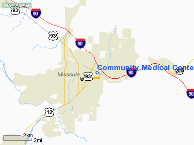
Community Medical Center Heliport |
Location & QuickFacts
| FAA Information Effective: | 2008-09-25 |
| Airport Identifier: | 2MT3 |
| Airport Status: | Operational |
| Longitude/Latitude: | 113-59-26.3920W/46-52-11.7250N
-113.990664/46.869924 (Estimated) |
| Elevation: | 3160 ft / 963.17 m (Estimated) |
| Land: | 0 acres |
| From nearest city: | 0 nautical miles N of Missoula, MT |
| Location: | Missoula County, MT |
| Magnetic Variation: | 18E (1985) |
Owner & Manager
| Ownership: | Privately owned |
| Owner: | Community Medical Center |
| Address: | 2827 Ft Missoula Road
Missoula, MT 59801 |
| Phone number: | 406-728-4100 |
| Manager: | Devin Huntley |
| Address: | 2827 Fort Missoula Road
Missoula, MT 59801 |
| Phone number: | 406-728-4100 |
Airport Operations and Facilities
| Airport Use: | Private
MEDICAL USE. |
| Wind indicator: | Yes |
| Segmented Circle: | No |
| Control Tower: | No |
| Lighting Schedule: | PHONE REQ
FOR PERIMETER LGTS CALL 406-728-4100. |
| Sectional chart: | Great Falls |
| Region: | ANM - Northwest Mountain |
| Boundary ARTCC: | ZLC - Salt Lake City |
| Tie-in FSS: | GTF - Great Falls |
| FSS on Airport: | No |
| FSS Toll Free: | 1-800-WX-BRIEF |
Airport Services
| Airframe Repair: | NONE |
| Power Plant Repair: | NONE |
Runway Information
Helipad H1
| Dimension: | 40 x 40 ft / 12.2 x 12.2 m |
| Surface: | ASPH, Good Condition |
| Weight Limit: | Single wheel: 12000 lbs. |
| |
Runway H1 |
Runway |
| Traffic Pattern: | Left | Left |
| Markings: | Basic, Good Condition | , |
|
Radio Navigation Aids
| ID |
Type |
Name |
Ch |
Freq |
Var |
Dist |
| INE | NDB | Konna | | 521.00 | 17E | 21.4 nm |
| HMM | NDB | Hamilton | | 410.00 | 19E | 37.3 nm |
| DRU | VOR | Drummond | | 117.10 | 17E | 36.0 nm |
| MSO | VOR/DME | Missoula | 075X | 112.80 | 17E | 4.5 nm |
Images and information placed above are from
http://www.airport-data.com/airport/2MT3/
We thank them for the data!
| General Info
|
| Country |
United States
|
| State |
MONTANA
|
| FAA ID |
2MT3
|
| Latitude |
46-52-11.725N
|
| Longitude |
113-59-26.392W
|
| Elevation |
3160 feet
|
| Near City |
MISSOULA
|
We don't guarantee the information is fresh and accurate. The data may
be wrong or outdated.
For more up-to-date information please refer to other sources.
|
|


