 |
|
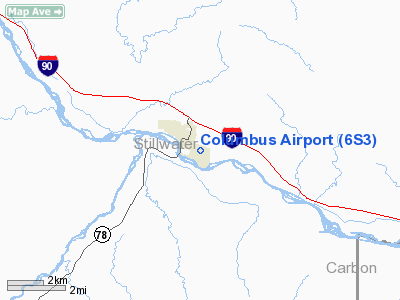
Location & QuickFacts
| FAA Information Effective: | 2008-09-25 |
| Airport Identifier: | 6S3 |
| Airport Status: | Operational |
| Longitude/Latitude: | 109-14-21.2600W/45-37-49.9350N
-109.239239/45.630538 (Estimated) |
| Elevation: | 3575 ft / 1089.66 m (Surveyed) |
| Land: | 120 acres |
| From nearest city: | 0 nautical miles SE of Columbus, MT |
| Location: | Stillwater County, MT |
| Magnetic Variation: | 15E (1985) |
Owner & Manager
| Ownership: | Publicly owned |
| Owner: | City Of Columbus & Stillwater Co |
| Address: | P O Box 970
Columbus, MT 59019 |
| Phone number: | 406-322-5313 |
| Manager: | Allen Rickman |
| Address: | Box 724
Columbus, MT 59019 |
| Phone number: | 406-322-5974 |
Airport Operations and Facilities
| Airport Use: | Open to public |
| Wind indicator: | Yes |
| Segmented Circle: | Yes |
| Control Tower: | No |
| Lighting Schedule: | DUSK-DAWN
ACTVT MIRL RY 10/28 AND PAPI RY 28 - CTAF. |
| Beacon Color: | Clear-Green (lighted land airport) |
| Landing fee charge: | No |
| Sectional chart: | Great Falls |
| Region: | ANM - Northwest Mountain |
| Boundary ARTCC: | ZLC - Salt Lake City |
| Tie-in FSS: | GTF - Great Falls |
| FSS on Airport: | No |
| FSS Toll Free: | 1-800-WX-BRIEF |
| NOTAMs Facility: | GTF (NOTAM-d service avaliable) |
| Federal Agreements: | N |
Airport Communications
| CTAF: | 122.800 |
| Unicom: | 122.800 |
Airport Services
| Fuel available: | 100LL |
| Airframe Repair: | MAJOR |
| Power Plant Repair: | MAJOR |
| Bottled Oxygen: | NONE |
| Bulk Oxygen: | NONE |
Runway Information
Runway 10/28
| Dimension: | 3814 x 75 ft / 1162.5 x 22.9 m |
| Surface: | ASPH, Good Condition |
| Weight Limit: | Single wheel: 12500 lbs. |
| Edge Lights: | Medium |
| |
Runway 10 |
Runway 28 |
| Longitude: | 109-14-46.1300W | 109-13-56.3900W |
| Latitude: | 45-37-57.0100N | 45-37-42.8600N |
| Elevation: | 3575.00 ft | 3561.00 ft |
| Traffic Pattern: | Left | Left |
| Markings: | Basic, Good Condition | Basic, Good Condition |
| Crossing Height: | 0.00 ft | 27.00 ft |
| VASI: | | 2-light PAPI on right side |
| Visual Glide Angle: | 0.00° | 3.00° |
| Obstruction: | 30 ft tree, 1424.0 ft from runway, 363 ft right of centerline, 40:1 slope to clear | 8 ft brush, 395.0 ft from runway, 60 ft right of centerline, 24:1 slope to clear |
|
Radio Navigation Aids
| ID |
Type |
Name |
Ch |
Freq |
Var |
Dist |
| RED | NDB | Red Lodge | | 203.00 | 17E | 23.5 nm |
| POY | NDB | Powell | | 344.00 | 15E | 49.7 nm |
| BIL | VORTAC | Billings | 092X | 114.50 | 14E | 27.9 nm |
Remarks
- REPAIR SVC ATTENDED WEEKDAYS 0800-1700 LCL.
Images and information placed above are from
http://www.airport-data.com/airport/6S3/
We thank them for the data!
| General Info
|
| Country |
United States
|
| State |
MONTANA
|
| FAA ID |
6S3
|
| Latitude |
45-37-44.787N
|
| Longitude |
109-15-02.580W
|
| Elevation |
3575 feet
|
| Near City |
COLUMBUS
|
We don't guarantee the information is fresh and accurate. The data may
be wrong or outdated.
For more up-to-date information please refer to other sources.
|
|


