 |
|
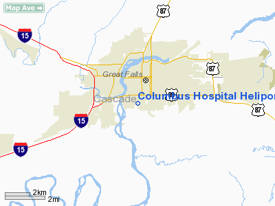
Columbus Hospital Heliport |
Location & QuickFacts
| FAA Information Effective: | 2008-09-25 |
| Airport Identifier: | MT27 |
| Airport Status: | Operational |
| Longitude/Latitude: | 111-17-46.8690W/47-29-17.1130N
-111.296352/47.488087 (Estimated) |
| Elevation: | 3418 ft / 1041.81 m (Estimated) |
| Land: | 0 acres |
| From nearest city: | 0 nautical miles N of Great Falls, MT |
| Location: | Cascade County, MT |
| Magnetic Variation: | 18E (1985) |
Owner & Manager
| Ownership: | Privately owned |
| Owner: | Columbus Hospital |
| Address: | P O Box 5013
Great Falls, MT 59403 |
| Phone number: | 406-727-3333 |
| Manager: | William J. Downer |
| Address: | P O Box 5013
Great Falls, MT 59403 |
| Phone number: | 406-727-3333 |
Airport Operations and Facilities
| Airport Use: | Private
MEDICAL USE. |
| Wind indicator: | Yes |
| Segmented Circle: | No |
| Control Tower: | No |
| Lighting Schedule: | PHONE REQ
FOR PERIMETER LGTS CALL 406-727-3333. |
| Landing fee charge: | No |
| Sectional chart: | Great Falls |
| Region: | ANM - Northwest Mountain |
| Boundary ARTCC: | ZLC - Salt Lake City |
| Tie-in FSS: | GTF - Great Falls |
| FSS on Airport: | No |
| FSS Toll Free: | 1-800-WX-BRIEF |
Runway Information
Helipad H1
| Dimension: | 55 x 55 ft / 16.8 x 16.8 m |
| Surface: | ASPH-CONC, |
| |
Runway H1 |
Runway |
| Traffic Pattern: | Left | Left |
|
Radio Navigation Aids
| ID |
Type |
Name |
Ch |
Freq |
Var |
Dist |
| ITU | NDB | Truly | | 371.00 | 16E | 8.0 nm |
| CII | NDB | Choteau | | 269.00 | 17E | 40.7 nm |
| CRD | NDB | Conrad | | 293.00 | 17E | 48.8 nm |
| GFA | TACAN | Malmstrom | 105X | | 17E | 4.7 nm |
| GTF | VORTAC | Great Falls | 098X | 115.10 | 16E | 5.2 nm |
Remarks
- E111 PRVDD INGRESS/EGRESS RTES ESTABD TO/FROM WEST; SOUTHWEST OR NORTH. E111 PRVDD 2-WAY RADIO COM WITH GREAT FALLS ATC ARE ESTABD & MAINTD PRIOR TO & DURG FLTS WITHIN GREAT FALLS CTLZ.
Images and information placed above are from
http://www.airport-data.com/airport/MT27/
We thank them for the data!
| General Info
|
| Country |
United States
|
| State |
MONTANA
|
| FAA ID |
MT27
|
| Latitude |
47-29-17.113N
|
| Longitude |
111-17-46.869W
|
| Elevation |
3418 feet
|
| Near City |
GREAT FALLS
|
We don't guarantee the information is fresh and accurate. The data may
be wrong or outdated.
For more up-to-date information please refer to other sources.
|
|


