 |
|
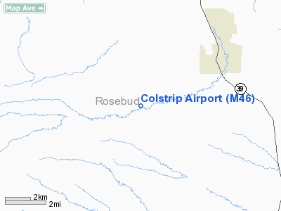
Location & QuickFacts
| FAA Information Effective: | 2008-09-25 |
| Airport Identifier: | M46 |
| Airport Status: | Operational |
| Longitude/Latitude: | 106-42-33.3800W/45-51-10.2600N
-106.709272/45.852850 (Estimated) |
| Elevation: | 3426 ft / 1044.24 m (Estimated) |
| Land: | 188 acres |
| From nearest city: | 3 nautical miles SW of Colstrip, MT |
| Location: | Rosebud County, MT |
| Magnetic Variation: | 13E (1995) |
Owner & Manager
| Ownership: | Publicly owned |
| Owner: | County Of Rosebud |
| Address: | Po Box 47
Forsyth, MT 59327 |
| Phone number: | 406-356-2251 |
| Manager: | Ruben Jodsass |
| Address: | P.o. Box 396
Colstrip, MT 59323 |
| Phone number: | 406-748-2217 |
Airport Operations and Facilities
| Airport Use: | Open to public |
| Wind indicator: | Yes |
| Segmented Circle: | Yes |
| Control Tower: | No |
| Lighting Schedule: | DUSK-DAWN
MIRL RY 06/24 & PAPI RYS 06 & 24 PRESET LOW INTST DUSK-2300; AFTER 2300 ACTVT - CTAF. |
| Beacon Color: | Clear-Green (lighted land airport) |
| Sectional chart: | Billings |
| Region: | ANM - Northwest Mountain |
| Boundary ARTCC: | ZLC - Salt Lake City |
| Tie-in FSS: | GTF - Great Falls |
| FSS on Airport: | No |
| FSS Toll Free: | 1-800-WX-BRIEF |
| NOTAMs Facility: | GTF (NOTAM-d service avaliable) |
| Federal Agreements: | NGY |
Airport Communications
Airport Services
Runway Information
Runway 06/24
| Dimension: | 5100 x 75 ft / 1554.5 x 22.9 m |
| Surface: | ASPH, Good Condition |
| Weight Limit: | Single wheel: 12500 lbs. |
| Edge Lights: | Medium |
| |
Runway 06 |
Runway 24 |
| Longitude: | 106-43-08.1000W | 106-41-58.6600W |
| Latitude: | 45-51-03.5500N | 45-51-16.9700N |
| Elevation: | 3426.00 ft | 3382.00 ft |
| Alignment: | 75 | 127 |
| Traffic Pattern: | Left | Left |
| Markings: | Basic, Fair Condition | Basic, Fair Condition |
| Crossing Height: | 26.00 ft | 26.00 ft |
| VASI: | 2-light PAPI on left side | 2-light PAPI on left side |
| Visual Glide Angle: | 3.00° | 3.00° |
| Obstruction: | 51 ft hill, 2435.0 ft from runway, 325 ft left of centerline, 43:1 slope to clear | , 50:1 slope to clear |
|
Radio Navigation Aids
| ID |
Type |
Name |
Ch |
Freq |
Var |
Dist |
| FOR | NDB | Forsyth | | 236.00 | 14E | 26.3 nm |
| HTN | NDB | Horton | | 320.00 | 15E | 46.5 nm |
| MLS | VORTAC | Miles City | 058X | 112.10 | 15E | 44.8 nm |
Remarks
- HILL 1550' FM RY 24 END 600' LEFT & 93' ABOVE RY THR.
- 700 FT POWER PLANT STACKS 4.5 NM NE OF ARPT.
- DEER ON AIRPORT.
- PHONE AVAIL ON ARPT.
Images and information placed above are from
http://www.airport-data.com/airport/M46/
We thank them for the data!
| General Info
|
| Country |
United States
|
| State |
MONTANA
|
| FAA ID |
M46
|
| Latitude |
45-51-10.260N
|
| Longitude |
106-42-33.380W
|
| Elevation |
3426 feet
|
| Near City |
COLSTRIP
|
We don't guarantee the information is fresh and accurate. The data may
be wrong or outdated.
For more up-to-date information please refer to other sources.
|
|


