 |
|
Location & QuickFacts
| FAA Information Effective: | 2008-09-25 |
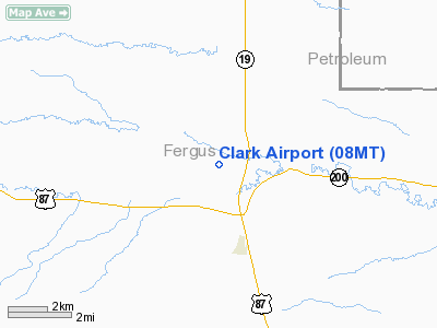
| Airport Identifier: | 08MT |
| Airport Status: | Operational |
| Longitude/Latitude: | 108-49-02.5290W/47-03-49.9060N
-108.817369/47.063863 (Estimated) |
| Elevation: | 3450 ft / 1051.56 m (Estimated) |
| Land: | 0 acres |
| From nearest city: | 3 nautical miles N of Grassrange, MT |
| Location: | Fergus County, MT |
| Magnetic Variation: | 15E (1985) |
Owner & Manager
| Ownership: | Privately owned |
| Owner: | Don Clark |
| Address: | Box 16
Gardiner, MT 59030 |
| Phone number: | 406-848-7828 |
| Address: |
|
Airport Operations and Facilities
| Airport Use: | Private |
| Wind indicator: | Yes |
| Segmented Circle: | No |
| Control Tower: | No |
| Landing fee charge: | No |
| Sectional chart: | Billings |
| Region: | ANM - Northwest Mountain |
| Boundary ARTCC: | ZLC - Salt Lake City |
| Tie-in FSS: | GTF - Great Falls |
| FSS on Airport: | No |
| FSS Toll Free: | 1-800-WX-BRIEF |
Airport Services
| Airframe Repair: | NONE |
| Power Plant Repair: | NONE |
Runway Information
Runway 07/25
| Dimension: | 2600 x 80 ft / 792.5 x 24.4 m |
| Surface: | DIRT, |
| |
Runway 07 |
Runway 25 |
| Traffic Pattern: | Left | Left |
|
Radio Navigation Aids
| ID |
Type |
Name |
Ch |
Freq |
Var |
Dist |
| LWT | NDB | Lewistown | | 353.00 | 17E | 29.4 nm |
| RPX | NDB | Roundup | | 362.00 | 17E | 36.5 nm |
| LWT | VORTAC | Lewistown | 057X | 112.00 | 15E | 32.3 nm |
Images and information placed above are from
http://www.airport-data.com/airport/08MT/
We thank them for the data!
| General Info
|
| Country |
United States
|
| State |
MONTANA
|
| FAA ID |
08MT
|
| Latitude |
47-03-49.906N
|
| Longitude |
108-49-02.529W
|
| Elevation |
3450 feet
|
| Near City |
GRASSRANGE
|
We don't guarantee the information is fresh and accurate. The data may
be wrong or outdated.
For more up-to-date information please refer to other sources.
|
|


