 |
|
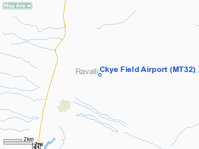
Location & QuickFacts
| FAA Information Effective: | 2008-09-25 |
| Airport Identifier: | MT32 |
| Airport Status: | Operational |
| Longitude/Latitude: | 114-02-23.3720W/46-32-19.7210N
-114.039826/46.538811 (Estimated) |
| Elevation: | 3600 ft / 1097.28 m (Estimated) |
| Land: | 0 acres |
| From nearest city: | 3 nautical miles NE of Stevensville, MT |
| Location: | Ravalli County, MT |
| Magnetic Variation: | 18E (1985) |
Owner & Manager
| Ownership: | Privately owned |
| Owner: | Craig E & Lynnet M Thomas |
| Address: | 4189 Ember Lane
Stevensville, MT 59870 |
| Phone number: | 406-777-3041 |
| Manager: | Craig E Thomas |
| Address: | 4189 Ember Lane
Stevensville, MT 59870 |
| Phone number: | 406-777-3041 |
Airport Operations and Facilities
| Airport Use: | Private |
| Wind indicator: | Yes |
| Segmented Circle: | No |
| Control Tower: | No |
| Landing fee charge: | No |
| Sectional chart: | Great Falls |
| Region: | ANM - Northwest Mountain |
| Boundary ARTCC: | ZLC - Salt Lake City |
| Tie-in FSS: | GTF - Great Falls |
| FSS on Airport: | No |
| FSS Toll Free: | 1-800-WX-BRIEF |
Runway Information
Runway NW/SE
| Dimension: | 2000 x 50 ft / 609.6 x 15.2 m |
| Surface: | TURF, |
| |
Runway NW |
Runway SE |
| Traffic Pattern: | Right | Right |
|
Radio Navigation Aids
| ID |
Type |
Name |
Ch |
Freq |
Var |
Dist |
| HMM | NDB | Hamilton | | 410.00 | 19E | 17.4 nm |
| INE | NDB | Konna | | 521.00 | 17E | 36.5 nm |
| DRU | VOR | Drummond | | 117.10 | 17E | 35.7 nm |
| MSO | VOR/DME | Missoula | 075X | 112.80 | 17E | 22.3 nm |
Remarks
- PRVDD ARPT IS ESTAB & OPERD AS PSNAL USE ONLY; RWY IS REALIGNED SO IT IS PARALLEL TO EXISTING RWY 13/31 AT THE PUB-USE STEVENSVILLE ARPT; ALL TFC PAT OPNS ARE CONDUCTED TO THE NE OF THE NW/SE RWY; I.E., ALL TURNS TO LEFT WHEN LNDG OR DEP THE SE RWY & ALL TURNS TO RIGHT WHEN LNDG OR DEP THE NW RWY.
Images and information placed above are from
http://www.airport-data.com/airport/MT32/
We thank them for the data!
| General Info
|
| Country |
United States
|
| State |
MONTANA
|
| FAA ID |
MT32
|
| Latitude |
46-32-19.721N
|
| Longitude |
114-02-23.372W
|
| Elevation |
3600 feet
|
| Near City |
STEVENSVILLE
|
We don't guarantee the information is fresh and accurate. The data may
be wrong or outdated.
For more up-to-date information please refer to other sources.
|
|


