 |
|
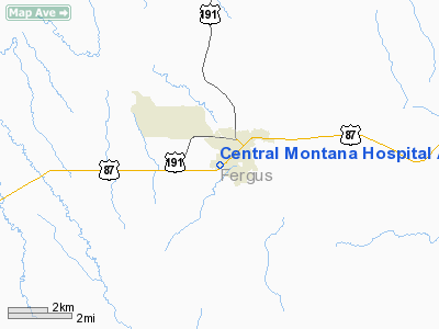
Central Montana Hospital And Nursing Home Heliport |
Location & QuickFacts
| FAA Information Effective: | 2008-09-25 |
| Airport Identifier: | MT31 |
| Airport Status: | Operational |
| Longitude/Latitude: | 109-26-22.6580W/47-03-28.9030N
-109.439627/47.058029 (Estimated) |
| Elevation: | 4200 ft / 1280.16 m (Estimated) |
| Land: | 10 acres |
| From nearest city: | 0 nautical miles W of Lewistown, MT |
| Location: | Fergus County, MT |
| Magnetic Variation: | 16E (1985) |
Owner & Manager
| Ownership: | Privately owned |
| Owner: | Central Montana Hospital |
| Address: | 408 Wendell Ave
Lewistown, MT 59457 |
| Phone number: | 406-538-7711 |
| Manager: | Ron Bauman |
| Address: | 408 Wendell Ave
Lewistown, MT 59457 |
| Phone number: | 406-538-6231 |
Airport Operations and Facilities
| Airport Use: | Private
MEDICAL USE. |
| Wind indicator: | No |
| Segmented Circle: | Yes |
| Control Tower: | No |
| Lighting Schedule: | PHONE REQ
FOR LGTS CALL 406-538-7711. |
| Landing fee charge: | No |
| Sectional chart: | Great Falls |
| Region: | ANM - Northwest Mountain |
| Boundary ARTCC: | ZLC - Salt Lake City |
| Tie-in FSS: | GTF - Great Falls |
| FSS on Airport: | No |
| FSS Toll Free: | 1-800-WX-BRIEF |
Runway Information
Helipad H1
| Dimension: | 75 x 75 ft / 22.9 x 22.9 m |
| Surface: | TURF, |
| |
Runway H1 |
Runway |
| Traffic Pattern: | Left | Left |
| Obstruction: | 40 ft poles, 1400.0 ft from runway | |
|
Radio Navigation Aids
| ID |
Type |
Name |
Ch |
Freq |
Var |
Dist |
| LWT | NDB | Lewistown | | 353.00 | 17E | 4.0 nm |
| HWQ | NDB | Harlowton | | 242.00 | 17E | 40.8 nm |
| RPX | NDB | Roundup | | 362.00 | 17E | 49.9 nm |
| LWT | VORTAC | Lewistown | 057X | 112.00 | 15E | 6.8 nm |
Remarks
- PRVDD A LETTER OF AGREEMENT BTWN LEWISTOWN FSS & CENTRAL MONTANA HOSPITAL IS EFFECTED PRIOR TO COMMENCEMENT OF OPERATIONS.
Images and information placed above are from
http://www.airport-data.com/airport/MT31/
We thank them for the data!
| General Info
|
| Country |
United States
|
| State |
MONTANA
|
| FAA ID |
MT31
|
| Latitude |
47-03-28.903N
|
| Longitude |
109-26-22.658W
|
| Elevation |
4200 feet
|
| Near City |
LEWISTOWN
|
We don't guarantee the information is fresh and accurate. The data may
be wrong or outdated.
For more up-to-date information please refer to other sources.
|
|


