 |
|
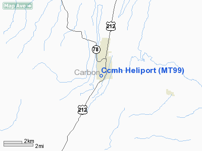
Location & QuickFacts
| FAA Information Effective: | 2008-09-25 |
| Airport Identifier: | MT99 |
| Airport Status: | Operational |
| Longitude/Latitude: | 109-15-12.6000W/45-10-39.8000N
-109.253500/45.177722 (Estimated) |
| Elevation: | 5555 ft / 1693.16 m (Estimated) |
| Land: | 1 acres |
| From nearest city: | 0 nautical miles N of Red Lodge, MT |
| Location: | Carbon County, MT |
| Magnetic Variation: | 14E (1995) |
Owner & Manager
| Ownership: | Privately owned |
| Owner: | Beartooth Hospital And Health Ctr |
| Address: | 600 West 21 Street
Red Lodge, MT 59068 |
| Phone number: | 406-446-2345 |
| Manager: | Kelley Evans Adm. |
| Address: | P.o. Box 590
Red Lodge, MT 59068 |
| Phone number: | 406-446-2345 |
Airport Operations and Facilities
| Airport Use: | Private
MEDICAL USE. |
| Wind indicator: | Yes |
| Segmented Circle: | No |
| Control Tower: | No |
| Lighting Schedule: | PHONE REQ
FOR PERIMETER LIGHTS CALL 406-446-2345 5 MIN PRIOR TO LANDING. |
| Landing fee charge: | No |
| Sectional chart: | Great Falls |
| Region: | ANM - Northwest Mountain |
| Boundary ARTCC: | ZLC - Salt Lake City |
| Tie-in FSS: | GTF - Great Falls |
| FSS on Airport: | No |
| FSS Toll Free: | 1-800-WX-BRIEF |
Runway Information
Helipad H1
| Dimension: | 36 x 36 ft / 11.0 x 11.0 m |
| Surface: | CONC, |
| |
Runway H1 |
Runway |
| Traffic Pattern: | Left | Left |
|
Radio Navigation Aids
| ID |
Type |
Name |
Ch |
Freq |
Var |
Dist |
| RED | NDB | Red Lodge | | 203.00 | 17E | 3.8 nm |
| POY | NDB | Powell | | 344.00 | 15E | 27.3 nm |
| HCY | NDB | Cowley | | 257.00 | 14E | 37.9 nm |
| COD | VOR/DME | Cody | 055X | 111.80 | 14E | 35.7 nm |
| BIL | VORTAC | Billings | 092X | 114.50 | 14E | 46.3 nm |
Remarks
- PRVDD DRIVEWAY SIGN LOWERED 6 FT & TREE LCTD 95 FT N OF PROPOSED CNTR OF HELIPAD TOPPED BY 10 FT.
Images and information placed above are from
http://www.airport-data.com/airport/MT99/
We thank them for the data!
| General Info
|
| Country |
United States
|
| State |
MONTANA
|
| FAA ID |
MT99
|
| Latitude |
45-10-39.800N
|
| Longitude |
109-15-12.600W
|
| Elevation |
5555 feet
|
| Near City |
RED LODGE
|
We don't guarantee the information is fresh and accurate. The data may
be wrong or outdated.
For more up-to-date information please refer to other sources.
|
|


