 |
|
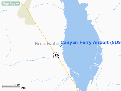
Location & QuickFacts
| FAA Information Effective: | 2008-09-25 |
| Airport Identifier: | 8U9 |
| Airport Status: | Operational |
| Longitude/Latitude: | 111-34-37.8980W/46-25-07.7560N
-111.577194/46.418821 (Estimated) |
| Elevation: | 3840 ft / 1170.43 m (Estimated) |
| Land: | 39 acres |
| From nearest city: | 7 nautical miles NW of Townsend, MT |
| Location: | Broadwater County, MT |
| Magnetic Variation: | 17E (1985) |
Owner & Manager
| Ownership: | Publicly owned |
| Owner: | Broadwater County |
| Address: | 515 Broadway
Townsend, MT 59644 |
| Manager: | Duane Halbertson |
| Address: | P.o. Box 55, #16
Townsend, MT 59644 |
| Phone number: | 406-266-4708 |
Airport Operations and Facilities
| Airport Use: | Open to public |
| Wind indicator: | Yes |
| Segmented Circle: | Yes |
| Control Tower: | No |
| Landing fee charge: | No |
| Sectional chart: | Great Falls |
| Region: | ANM - Northwest Mountain |
| Boundary ARTCC: | ZLC - Salt Lake City |
| Tie-in FSS: | GTF - Great Falls |
| FSS on Airport: | No |
| FSS Toll Free: | 1-800-WX-BRIEF |
| NOTAMs Facility: | GTF (NOTAM-d service avaliable) |
Airport Communications
| CTAF: | 122.800 |
| Unicom: | 122.800 |
Airport Services
| Airframe Repair: | NONE |
| Power Plant Repair: | NONE |
| Bottled Oxygen: | NONE |
| Bulk Oxygen: | NONE |
Runway Information
Runway 16/34
| Dimension: | 3200 x 75 ft / 975.4 x 22.9 m |
| Surface: | TREATED, |
| |
Runway 16 |
Runway 34 |
| Traffic Pattern: | Left | Left |
| Markings: | Basic, Good Condition
16/34 MARKED WITH WHITE CONES SPACED 200 FT APART. RY 34 DSPLCD THR MARKED WITH RED CONES. | Basic, Good Condition |
| Displaced threshold: | 0.00 ft | 597.00 ft |
| Obstruction: | , 50:1 slope to clear | 10 ft road, 11.0 ft from runway, 1:1 slope to clear
APCH SLOPE 50:1 FM DSPLCD THR. |
|
Radio Navigation Aids
| ID |
Type |
Name |
Ch |
Freq |
Var |
Dist |
| HAU | NDB | Hauser | | 386.00 | 16E | 11.7 nm |
| CVP | NDB | Capitol | | 335.00 | 16E | 18.7 nm |
| BZN | VOR/DME | Bozeman | 071X | 112.40 | 18E | 42.0 nm |
| HLN | VORTAC | Helena | 124X | 117.70 | 16E | 19.2 nm |
| HIA | VORTAC | Whitehall | 084X | 113.70 | 18E | 41.6 nm |
Remarks
- NO SNOW REMOVAL.
- RY 16/34 SFC ROUGH DUE TO ROCKS.
Images and information placed above are from
http://www.airport-data.com/airport/8U9/
We thank them for the data!
| General Info
|
| Country |
United States
|
| State |
MONTANA
|
| FAA ID |
8U9
|
| Latitude |
46-25-07.756N
|
| Longitude |
111-34-37.898W
|
| Elevation |
3840 feet
|
| Near City |
TOWNSEND
|
We don't guarantee the information is fresh and accurate. The data may
be wrong or outdated.
For more up-to-date information please refer to other sources.
|
|


