 |
|
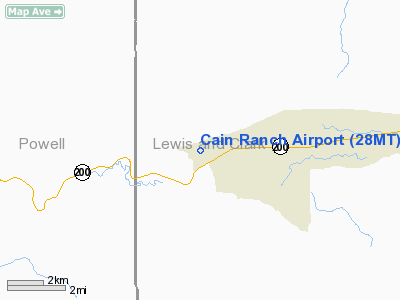
Location & QuickFacts
| FAA Information Effective: | 2008-09-25 |
| Airport Identifier: | 28MT |
| Airport Status: | Operational |
| Longitude/Latitude: | 112-44-53.1000W/46-57-12.8000N
-112.748083/46.953556 (Estimated) |
| Elevation: | 4480 ft / 1365.50 m (Estimated) |
| Land: | 0 acres |
| From nearest city: | 3 nautical miles W of Lincoln, MT |
| Location: | Lewis And Clark County, MT |
| Magnetic Variation: | () |
Owner & Manager
| Ownership: | Privately owned |
| Owner: | Jerome Morrison Cain |
| Address: | P. O. Box 1057
Lincoln, MT 59639 |
| Phone number: | 406-362-4743 |
| Manager: | Jerome Morrison Cain |
| Address: | P. O. Box 1057
Lincoln, MT 59639 |
| Phone number: | 406-362-4743 |
Airport Operations and Facilities
| Airport Use: | Private |
| Control Tower: | No |
| Sectional chart: | Great Falls |
| Region: | ANM - Northwest Mountain |
| Boundary ARTCC: | ZLC - Salt Lake City |
| Tie-in FSS: | GTF - Great Falls |
| FSS Toll Free: | 1-800-WX-BRIEF |
Runway Information
Runway 16/34
| Dimension: | 3200 x 40 ft / 975.4 x 12.2 m |
| Surface: | TURF, |
| |
Runway 16 |
Runway 34 |
| Traffic Pattern: | Left | Left |
| Displaced threshold: | 1600.00 ft
DSPLCD THLD RY 16 MKD WITH TWO WHITE 2.5 GALLON JUGS ON BOTH SIDES OF THE RY | 0.00 ft |
| Obstruction: | 80 ft pline | 4 ft fence, 80.0 ft from runway |
|
Radio Navigation Aids
| ID |
Type |
Name |
Ch |
Freq |
Var |
Dist |
| CVP | NDB | Capitol | | 335.00 | 16E | 39.4 nm |
| HAU | NDB | Hauser | | 386.00 | 16E | 46.9 nm |
| DRU | VOR | Drummond | | 117.10 | 17E | 26.3 nm |
| HLN | VORTAC | Helena | 124X | 117.70 | 16E | 38.8 nm |
Remarks
- WIND PERMITTING DEPART TO THE SOUTH DUE TO THE PLINE RY 16.
Images and information placed above are from
http://www.airport-data.com/airport/28MT/
We thank them for the data!
We don't guarantee the information is fresh and accurate. The data may
be wrong or outdated.
For more up-to-date information please refer to other sources.
|
|


