 |
|
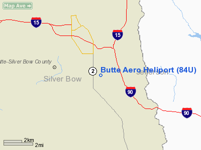
Location & QuickFacts
| FAA Information Effective: | 2008-09-25 |
| Airport Identifier: | 84U |
| Airport Status: | Operational |
| Longitude/Latitude: | 112-29-49.9700W/45-57-11.9350N
-112.497214/45.953315 (Estimated) |
| Elevation: | 5553 ft / 1692.55 m (Estimated) |
| Land: | 1 acres |
| From nearest city: | 4 nautical miles SE of Butte, MT |
| Location: | Silver Bow County, MT |
| Magnetic Variation: | 17E (1985) |
Owner & Manager
| Ownership: | Publicly owned |
| Owner: | Bert Mooney Arpt Auth |
| Address: | 111 Airport Rd
Butte, MT 59701 |
| Phone number: | 406-494-3771 |
| Manager: | Bert Mooney Arpt Auth |
| Address: | 111 Airport Rd
Butte, MT 59701 |
| Phone number: | 406-494-3771 |
Airport Operations and Facilities
| Airport Use: | Open to public |
| Wind indicator: | Yes |
| Segmented Circle: | No |
| Control Tower: | No |
| Lighting Schedule: | DUSK-DAWN |
| Beacon Color: | Clear-Green (lighted land airport) |
| Landing fee charge: | No |
| Sectional chart: | Great Falls |
| Region: | ANM - Northwest Mountain |
| Boundary ARTCC: | ZLC - Salt Lake City |
| Tie-in FSS: | GTF - Great Falls |
| FSS on Airport: | No |
| FSS Toll Free: | 1-800-WX-BRIEF |
| NOTAMs Facility: | GTF (NOTAM-d service avaliable) |
Airport Communications
| CTAF: | 123.000 |
| Unicom: | 123.000 |
Airport Services
| Fuel available: | 100 100LLA |
| Airframe Repair: | MAJOR |
| Power Plant Repair: | MAJOR |
| Bottled Oxygen: | HIGH/LOW |
| Bulk Oxygen: | HIGH/LOW |
Runway Information
Helipad H2
| Dimension: | 80 x 30 ft / 24.4 x 9.1 m |
| Surface: | ASPH, Fair Condition |
| |
Runway H2 |
Runway |
| Traffic Pattern: | Left | Left |
|
Radio Navigation Aids
| ID |
Type |
Name |
Ch |
Freq |
Var |
Dist |
| CVP | NDB | Capitol | | 335.00 | 16E | 45.6 nm |
| HAU | NDB | Hauser | | 386.00 | 16E | 48.1 nm |
| CPN | VOR/DME | Coppertown | 053X | 111.60 | 16E | 11.5 nm |
| DLN | VOR/DME | Dillon | 077X | 113.00 | 18E | 42.4 nm |
| HIA | VORTAC | Whitehall | 084X | 113.70 | 18E | 14.8 nm |
| HLN | VORTAC | Helena | 124X | 117.70 | 16E | 45.3 nm |
Remarks
- FOR CUSTOMS CTC GREAT FALLS AFSS.
- HELIPAD MAY BE USED FOR SNOWPILING DURING WINTER MONTHS CONTACT AMGR 406-494-3771 FOR CURRENT CONDITIONS.
Images and information placed above are from
http://www.airport-data.com/airport/84U/
We thank them for the data!
| General Info
|
| Country |
United States
|
| State |
MONTANA
|
| FAA ID |
84U
|
| Latitude |
45-57-11.935N
|
| Longitude |
112-29-49.970W
|
| Elevation |
5553 feet
|
| Near City |
BUTTE
|
We don't guarantee the information is fresh and accurate. The data may
be wrong or outdated.
For more up-to-date information please refer to other sources.
|
|


