 |
|
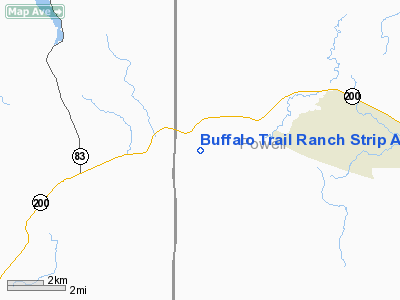
Buffalo Trail Ranch Strip Airport |
Location & QuickFacts
| FAA Information Effective: | 2008-09-25 |
| Airport Identifier: | MT16 |
| Airport Status: | Operational |
| Longitude/Latitude: | 113-17-00.2490W/47-00-49.7710N
-113.283403/47.013825 (Estimated) |
| Elevation: | 3906 ft / 1190.55 m (Estimated) |
| Land: | 0 acres |
| From nearest city: | 6 nautical miles W of Ovando, MT |
| Location: | Powell County, MT |
| Magnetic Variation: | 18E (1985) |
Owner & Manager
| Ownership: | Privately owned |
| Owner: | Paul B Brunner |
| Address: | Buffalo Trail Ranch
Ovando, MT 59854 |
| Phone number: | 406-793-5573 |
| Manager: | Roy Taylor |
| Address: |
|
| Phone number: | 406-793-5599 |
Airport Operations and Facilities
| Airport Use: | Private |
| Wind indicator: | Yes |
| Segmented Circle: | No |
| Control Tower: | No |
| Landing fee charge: | No |
| Sectional chart: | Great Falls |
| Region: | ANM - Northwest Mountain |
| Boundary ARTCC: | ZLC - Salt Lake City |
| Tie-in FSS: | GTF - Great Falls |
| FSS on Airport: | No |
| FSS Toll Free: | 1-800-WX-BRIEF |
Runway Information
Runway E/W
| Dimension: | 3000 x 60 ft / 914.4 x 18.3 m |
| Surface: | TURF-DIRT, |
| |
Runway E |
Runway W |
| Traffic Pattern: | Left | Left |
|
Radio Navigation Aids
| ID |
Type |
Name |
Ch |
Freq |
Var |
Dist |
| INE | NDB | Konna | | 521.00 | 17E | 45.9 nm |
| DRU | VOR | Drummond | | 117.10 | 17E | 23.1 nm |
| MSO | VOR/DME | Missoula | 075X | 112.80 | 17E | 33.4 nm |
Remarks
- IN WINDY CONDITIONS STRIP IS SUBJECT TO GUSTY CROSSWINDS.
- RECORD PURPOSES ONLY.
Images and information placed above are from
http://www.airport-data.com/airport/MT16/
We thank them for the data!
| General Info
|
| Country |
United States
|
| State |
MONTANA
|
| FAA ID |
MT16
|
| Latitude |
47-00-49.771N
|
| Longitude |
113-17-00.249W
|
| Elevation |
3906 feet
|
| Near City |
OVANDO
|
We don't guarantee the information is fresh and accurate. The data may
be wrong or outdated.
For more up-to-date information please refer to other sources.
|
|


