 |
|
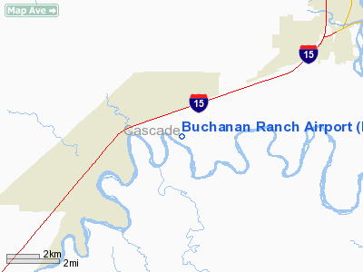
Location & QuickFacts
| FAA Information Effective: | 2008-09-25 |
| Airport Identifier: | MT75 |
| Airport Status: | Operational |
| Longitude/Latitude: | 111-27-36.8930W/47-25-48.8420N
-111.460248/47.430234 (Estimated) |
| Elevation: | 3345 ft / 1019.56 m (Estimated) |
| Land: | 60 acres |
| From nearest city: | 11 nautical miles SW of Great Falls, MT |
| Location: | Cascade County, MT |
| Magnetic Variation: | 17E (1985) |
Owner & Manager
| Ownership: | Privately owned |
| Owner: | John Buchanan |
| Address: | Po Box 1643
Great Falls, MT 59403 |
| Phone number: | 406-727-3969 |
| Manager: | John Buchanan |
| Address: | Po Box 1643
Great Falls, MT 59403 |
| Phone number: | 406-727-3969 |
Airport Operations and Facilities
| Airport Use: | Private |
| Segmented Circle: | No |
| Control Tower: | No |
| Sectional chart: | Great Falls |
| Region: | ANM - Northwest Mountain |
| Boundary ARTCC: | ZLC - Salt Lake City |
| Tie-in FSS: | GTF - Great Falls |
| FSS Toll Free: | 1-800-WX-BRIEF |
Runway Information
Runway 05/23
| Dimension: | 3000 x 50 ft / 914.4 x 15.2 m |
| Surface: | TURF, |
| |
Runway 05 |
Runway 23 |
| Traffic Pattern: | Left | Left |
| Obstruction: | 20 ft gnd, 100.0 ft from runway | |
|
Radio Navigation Aids
| ID |
Type |
Name |
Ch |
Freq |
Var |
Dist |
| ITU | NDB | Truly | | 371.00 | 16E | 5.3 nm |
| CII | NDB | Choteau | | 269.00 | 17E | 37.2 nm |
| CRD | NDB | Conrad | | 293.00 | 17E | 49.0 nm |
| GFA | TACAN | Malmstrom | 105X | | 17E | 12.1 nm |
| GTF | VORTAC | Great Falls | 098X | 115.10 | 16E | 2.3 nm |
Images and information placed above are from
http://www.airport-data.com/airport/MT75/
We thank them for the data!
| General Info
|
| Country |
United States
|
| State |
MONTANA
|
| FAA ID |
MT75
|
| Latitude |
47-25-48.842N
|
| Longitude |
111-27-36.893W
|
| Elevation |
3345 feet
|
| Near City |
GREAT FALLS
|
We don't guarantee the information is fresh and accurate. The data may
be wrong or outdated.
For more up-to-date information please refer to other sources.
|
|


