 |
|
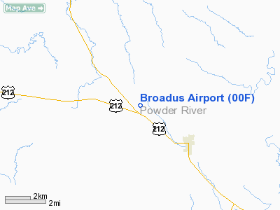
| Broadus Airport |
| IATA: none – ICAO: none – FAA LID: 00F |
| Summary |
| Airport type |
Public |
| Owner |
Powder River County |
| Serves |
Broadus, Montana |
| Elevation AMSL |
3,280 ft / 1,000 m |
| Coordinates |
45°28′14″N 105°27′26″W / 45.47056°N 105.45722°W / 45.47056; -105.45722 |
| Runways |
| Direction |
Length |
Surface |
| ft |
m |
| 10/28 |
4,400 |
1,341 |
Asphalt |
| Statistics (2006) |
| Aircraft operations |
5,350 |
| Source: Federal Aviation Administration |
Broadus Airport (FAA LID: 00F) is a county-owned, public-use airport located three miles (5 km) northwest of the central business district of Broadus, a town in Powder River County, Montana, United States. This new airport was built at a cost of $2 million to replace the old Broadus Airport which is now closed. Facilities and aircraft
Broadus Airport covers an area of 160 acres (65 ha) and had one runway designated 10/28 with a 4,400 by 75 ft (1,341 x 23 m) asphalt surface. For the 12-month period ending July 11, 2006, the airport had 5,350 aircraft operations, an average of 14 per day: 98% general aviation and 2% air taxi.
Old airport
The old Broadus Airport (IATA: BDX, ICAO: KBDX, FAA LID: BDX) was located at coordinates 45°25′59″N 105°25′01″W / 45.43306°N 105.41694°W / 45.43306; -105.41694 (Old Broadus Airport). It covered an area of 32 acres (13 ha) at an altitude of 3,034 feet (925 m) above mean sea level. The airport had one asphalt paved runway (11/29) measuring 3,150 by 50 ft (960 x 15 m).
The above content comes from Wikipedia and is published under free licenses – click here to read more.
Location & QuickFacts
| FAA Information Effective: | 2008-09-25 |
| Airport Identifier: | 00F |
| Airport Status: | Operational |
| Longitude/Latitude: | 105-27-26.1900W/45-28-13.6600N
-105.457275/45.470461 (Estimated) |
| Elevation: | 3280 ft / 999.74 m (Estimated) |
| Land: | 160 acres |
| From nearest city: | 3 nautical miles NW of Broadus, MT |
| Location: | Powder River County, MT |
| Magnetic Variation: | () |
Owner & Manager
| Ownership: | Publicly owned |
| Owner: | Powder River Co |
| Address: |
Broadus, MT 59317 |
| Phone number: | 406-436-2361 |
| Manager: | Warren Wash |
| Address: | Box 394
Broadus, MT 59317 |
| Phone number: | 406-853-0212 |
Airport Operations and Facilities
| Airport Use: | Open to public |
| Wind indicator: | Yes |
| Segmented Circle: | Yes |
| Control Tower: | No |
| Lighting Schedule: | DUSK-DAWN
MIRL RY 10/28 OPER DUSK-1000. AFTER 1000 ACTVT MIRL RY 10/28 - CTAF. |
| Beacon Color: | Clear-Green (lighted land airport) |
| Sectional chart: | Billings |
| Region: | ANM - Northwest Mountain |
| Boundary ARTCC: | ZLC - Salt Lake City |
| Tie-in FSS: | GTF - Great Falls |
| FSS Toll Free: | 1-800-WX-BRIEF |
| NOTAMs Facility: | GTF (NOTAM-d service avaliable) |
| Federal Agreements: | NGY |
Airport Communications
Airport Services
Runway Information
Runway 10/28
| Dimension: | 4400 x 75 ft / 1341.1 x 22.9 m |
| Surface: | ASPH, |
| Weight Limit: | Single wheel: 12500 lbs. |
| Edge Lights: | Medium |
| |
Runway 10 |
Runway 28 |
| Traffic Pattern: | Right | Left |
| Markings: | Non-precision instrument, Good Condition | Non-precision instrument, Good Condition |
|
Radio Navigation Aids
| ID |
Type |
Name |
Ch |
Freq |
Var |
Dist |
| BDX | NDB | Broadus | | 335.00 | 15E | 2.9 nm |
Images and information placed above are from
http://www.airport-data.com/airport/00F/
We thank them for the data!
| General Info
|
| Country |
United States
|
| State |
MONTANA
|
| FAA ID |
00F
|
| Latitude |
45.472528
45° 28' 21.10" N
|
| Longitude |
-105.453694
105° 27' 13.30" W
|
| Elevation |
2380 feet
725 meters
|
| Magnetic Variation |
010° E (06/06)
|
| Beacon |
Yes
|
| Operating Agency |
U.S.CIVIL AIRPORT WHEREIN PERMIT COVERS USE BY TRANSIT MILITARY AIRCRAFT
|
We don't guarantee the information is fresh and accurate. The data may
be wrong or outdated.
For more up-to-date information please refer to other sources.
|
|


