 |
|
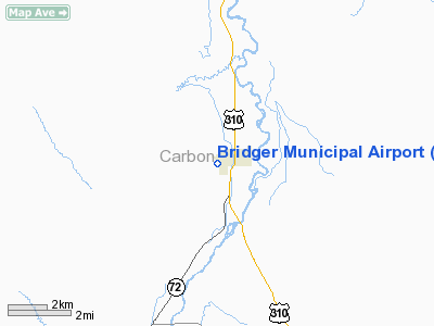
Bridger Municipal Airport |
Location & QuickFacts
| FAA Information Effective: | 2008-09-25 |
| Airport Identifier: | 6S1 |
| Airport Status: | Operational |
| Longitude/Latitude: | 108-55-32.5160W/45-17-29.8100N
-108.925699/45.291614 (Estimated) |
| Elevation: | 3720 ft / 1133.86 m (Estimated) |
| Land: | 104 acres |
| From nearest city: | 0 nautical miles W of Bridger, MT |
| Location: | Carbon County, MT |
| Magnetic Variation: | 15E (1985) |
Owner & Manager
| Ownership: | Publicly owned |
| Owner: | City Of Bridger/carbon Co |
| Address: | Po Box 368
Bridger, MT 59014 |
| Phone number: | 406-662-3677 |
| Manager: | Merril Pfeifer |
| Address: | Rte 1, Box 1178
Bridger, MT 59014 |
| Phone number: | 406-662-3319 |
Airport Operations and Facilities
| Airport Use: | Open to public |
| Wind indicator: | Yes |
| Segmented Circle: | Yes |
| Control Tower: | No |
| Lighting Schedule: | DUSK-DAWN
ACTVT LIRL RY 16/34 - CTAF. |
| Beacon Color: | Clear-Green (lighted land airport) |
| Landing fee charge: | No |
| Sectional chart: | Billings |
| Region: | ANM - Northwest Mountain |
| Boundary ARTCC: | ZLC - Salt Lake City |
| Tie-in FSS: | GTF - Great Falls |
| FSS on Airport: | No |
| FSS Toll Free: | 1-800-WX-BRIEF |
| NOTAMs Facility: | GTF (NOTAM-d service avaliable) |
Airport Communications
Airport Services
| Airframe Repair: | NONE |
| Power Plant Repair: | NONE |
| Bottled Oxygen: | NONE |
| Bulk Oxygen: | NONE |
Runway Information
Runway 16/34
| Dimension: | 3400 x 42 ft / 1036.3 x 12.8 m |
| Surface: | ASPH, Fair Condition |
| Weight Limit: | Single wheel: 4000 lbs. |
| Edge Lights: | Non-standard lighting system
LIRL NSTD. WEST SIDE 57 FT FROM PAVEMENT EDGE; EAST SIDE 47 FT FROM PAVEMENT EDGE. EACH THR HAS 4 LGTS TOTAL. |
| |
Runway 16 |
Runway 34 |
| Traffic Pattern: | Left | Right |
| Markings: | Basic, Good Condition | Basic, Good Condition
RY 34 DSPLCD THLD MKD BY NRS; 3280 FT AVBL FOR NGT OPR. |
| Displaced threshold: | 120.00 ft
RWY 16 THR RELOCATED 120 FT FOR NGT OPS ONLY NOT MARKED. | 475.00 ft |
| Obstruction: | 30 ft tree, 316.0 ft from runway, 96 ft left of centerline, 3:1 slope to clear
+2 FT BOULDER ON THLD LEFT BOUNDARY OF RY. +4 FT FENCE 75 FT L OF RY CNTRLN; -7 FT DITCH 116 FT FM EOR CROSSING RY CNTRLN & SHARP TERRAIN DROP OFF 46 FT R OF RY CNTRLN. | 40 ft hill, 1600.0 ft from runway, 35:1 slope to clear
ACPH RATIO 50:1 FM DSPLCD THLD.
RWY 34 +4 FT FENCE 96 FT RIGHT & PARALLEL TO RY; +3 FT BERM & 4 FT FENCE ON BERM 115 FT RIGHT & PARALLEL TO RY; SIGN 66 FT LEFT & 65 FT FM EOR; +60 FT POLES IN TRANS SURFACE WEST SIDE OF RY 34 THLD. RWY 34 3% UPHILL GRADE. |
|
Radio Navigation Aids
| ID |
Type |
Name |
Ch |
Freq |
Var |
Dist |
| RED | NDB | Red Lodge | | 203.00 | 17E | 14.7 nm |
| POY | NDB | Powell | | 344.00 | 15E | 26.2 nm |
| HCY | NDB | Cowley | | 257.00 | 14E | 30.6 nm |
| COD | VOR/DME | Cody | 055X | 111.80 | 14E | 40.4 nm |
| BIL | VORTAC | Billings | 092X | 114.50 | 14E | 33.6 nm |
Remarks
- ESTABLISHED PRIOR TO 1959
Images and information placed above are from
http://www.airport-data.com/airport/6S1/
We thank them for the data!
| General Info
|
| Country |
United States
|
| State |
MONTANA
|
| FAA ID |
6S1
|
| Latitude |
45-17-29.810N
|
| Longitude |
108-55-32.516W
|
| Elevation |
3720 feet
|
| Near City |
BRIDGER
|
We don't guarantee the information is fresh and accurate. The data may
be wrong or outdated.
For more up-to-date information please refer to other sources.
|
|


