 |
|
| Bowman Field |
| IATA: none – ICAO: none – FAA LID: 3U3 |
| Summary |
| Airport type |
Public |
| Owner |
Anaconda City & Deer Lodge County |
| Serves |
Anaconda, Montana |
| Elevation AMSL |
5,034 ft / 1,534 m |
| Coordinates |
46°09′11″N 112°52′04″W / 46.15306°N 112.86778°W / 46.15306; -112.86778 |
| Runways |
| Direction |
Length |
Surface |
| ft |
m |
| 16/34 |
6,011 |
1,832 |
Asphalt |
| 4/22 |
4,515 |
1,376 |
Asphalt |
| Statistics (2008) |
| Aircraft operations |
4,900 |
| Source: Federal Aviation Administration |
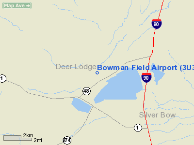
Bowman Field (FAA LID: 3U3) is a public airport located three miles (5 km) northeast of the central business district of Anaconda, a city in Deer Lodge County, Montana, United States. It is owned by Anaconda City and Deer Lodge County.
Facilities and aircraft
Bowman Field covers an area of 290 acres (117 ha) and has two asphalt paved runways: 16/34 measures 6,011 by 75 feet (1,832 by 23 m) and 4/22 measures 4,515 by 60 feet (1,376 by 18 m). For the 12-month period ending September 6, 2008, the airport had 4,900 aircraft operations, an average of 13 per day: 94% general aviation and 6% air taxi.
The above content comes from Wikipedia and is published under free licenses – click here to read more.
Location & QuickFacts
| FAA Information Effective: | 2008-09-25 |
| Airport Identifier: | 3U3 |
| Airport Status: | Operational |
| Longitude/Latitude: | 112-52-04.2240W/46-09-11.2780N
-112.867840/46.153133 (Estimated) |
| Elevation: | 5034 ft / 1534.36 m (Estimated) |
| Land: | 290 acres |
| From nearest city: | 3 nautical miles NE of Anaconda, MT |
| Location: | Deer Lodge County, MT |
| Magnetic Variation: | 16E (1990) |
Owner & Manager
| Ownership: | Publicly owned |
| Owner: | Anaconda City & Deerlodge Cty |
| Address: | Po Box 1412
Anaconda, MT 59711 |
| Phone number: | 406-563-4011 |
| Manager: | Jim Novak |
| Address: | 2010 Cable Road
Anaconda, MT 59711 |
| Phone number: | 406-563-2660
OR 406-593-1702. |
Airport Operations and Facilities
| Airport Use: | Open to public |
| Wind indicator: | Yes |
| Segmented Circle: | Yes |
| Control Tower: | No |
| Lighting Schedule: | DUSK-DAWN
ACTVT MIRL RYS 04/22 & 16/34; PAPI RYS 16 & 34 & 04 - CTAF. |
| Beacon Color: | Clear-Green (lighted land airport)
ROTG BCN LCTD MIDWAY OF RY 04/22 & OFFSET 700 FT SE OF CNTRLN. |
| Landing fee charge: | No |
| Sectional chart: | Great Falls |
| Region: | ANM - Northwest Mountain |
| Boundary ARTCC: | ZLC - Salt Lake City |
| Tie-in FSS: | GTF - Great Falls |
| FSS on Airport: | No |
| FSS Toll Free: | 1-800-WX-BRIEF |
| NOTAMs Facility: | GTF (NOTAM-d service avaliable) |
| Federal Agreements: | NGY |
Airport Communications
| CTAF: | 122.800 |
| Unicom: | 122.800 |
Airport Services
| Fuel available: | 100LLA |
| Bottled Oxygen: | NONE |
| Bulk Oxygen: | NONE |
Runway Information
Runway 04/22
| Dimension: | 4515 x 60 ft / 1376.2 x 18.3 m |
| Surface: | ASPH, Good Condition |
| Weight Limit: | Single wheel: 18000 lbs.
Dual wheel: 25000 lbs. |
| Edge Lights: | Medium |
| |
Runway 04 |
Runway 22 |
| Longitude: | 112-52-15.4080W | 112-51-21.4860W |
| Latitude: | 46-08-46.9530N | 46-09-11.0480N |
| Elevation: | 5030.00 ft | 4985.00 ft |
| Alignment: | 57 | 127 |
| Traffic Pattern: | Left | Left |
| Markings: | Basic, Good Condition | Basic, Good Condition |
| Crossing Height: | 44.00 ft | 0.00 ft |
| VASI: | 2-light PAPI on left side | |
| Visual Glide Angle: | 3.75° | 0.00° |
| Obstruction: | 84 ft pline, 1878.0 ft from runway, 19:1 slope to clear
+80' PLINE 250' LEFT OF RWY CNTRLN EXTENDED. | , 50:1 slope to clear |
|
Runway 16/34
| Dimension: | 6011 x 75 ft / 1832.2 x 22.9 m |
| Surface: | ASPH, Good Condition |
| Edge Lights: | Medium |
| |
Runway 16 |
Runway 34 |
| Longitude: | 112-52-16.0940W | 112-52-16.0500W |
| Latitude: | 46-09-50.1620N | 46-08-50.8340N |
| Elevation: | 4994.00 ft | 5029.00 ft |
| Alignment: | 127 | 127 |
| Traffic Pattern: | Left | Right |
| Markings: | Non-precision instrument, Fair Condition | Non-precision instrument, Fair Condition |
| Crossing Height: | 37.00 ft | 50.00 ft |
| VASI: | 2-light PAPI on left side | 2-light PAPI on left side |
| Visual Glide Angle: | 3.00° | 3.50° |
| Obstruction: | , 50:1 slope to clear | 51 ft tree, 877.0 ft from runway, 309 ft right of centerline, 13:1 slope to clear |
|
Radio Navigation Aids
| ID |
Type |
Name |
Ch |
Freq |
Var |
Dist |
| CVP | NDB | Capitol | | 335.00 | 16E | 47.2 nm |
| DRU | VOR | Drummond | | 117.10 | 17E | 31.9 nm |
| CPN | VOR/DME | Coppertown | 053X | 111.60 | 16E | 8.8 nm |
| HIA | VORTAC | Whitehall | 084X | 113.70 | 18E | 34.0 nm |
| HLN | VORTAC | Helena | 124X | 117.70 | 16E | 46.7 nm |
Remarks
- UNLIGHTED HAZARDOUS STACK; 585 FT AGL LCTD 3.2 NM SW OF ARPT.
- SELF SERVICE FUEL AVBL 24 HRS WITH CREDIT CARD.
Images and information placed above are from
http://www.airport-data.com/airport/3U3/
We thank them for the data!
| General Info
|
| Country |
United States
|
| State |
MONTANA
|
| FAA ID |
3U3
|
| Latitude |
46-09-11.278N
|
| Longitude |
112-52-04.224W
|
| Elevation |
5030 feet
|
| Near City |
ANACONDA
|
We don't guarantee the information is fresh and accurate. The data may
be wrong or outdated.
For more up-to-date information please refer to other sources.
|
|


